Area Overview for OX29 7PD
Photos of OX29 7PD
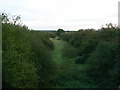


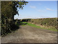
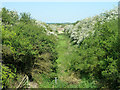
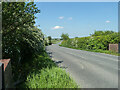
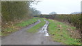
7 photos from this area
Area Information
Key information about the OX29 7PD including its size, population, and administrative classification.
- Area Type
- Postcode
- Area Size
- 1.4 km²
- Population
- 2420
- Population Density
- 116 people/km²
House Prices in OX29 7PD
33
Properties
£460,105
Average Sold Price
£132,000
Lowest Price
£752,500
Highest Price
Showing 33 properties
| Address | Type | Beds | Baths | Last Sale Price | Last Sale Date | |
|---|---|---|---|---|---|---|
| Dutton Cottage, Lew Road, Curbridge, Witney, OX29 7PD | Cottage | 2 | 1 | £370,750 | Dec 2024 | |
| Chestnut Cottage, Lew Road, Curbridge, Witney, OX29 7PD | Detached | 3 | 2 | £239,325 | Nov 2020 | |
| Beecham Cottage, Lew Road, Curbridge, Witney, OX29 7PD | Detached | 3 | 2 | £752,500 | Mar 2017 | |
| Glebe Cottage, Lew Road, Curbridge, Witney, OX29 7PD | Detached | 4 | 2 | £717,850 | Feb 2017 | |
| Mallard Cottage, Lew Road, Curbridge, Witney, OX29 7PD | Detached | - | - | £318,730 | Jun 2015 | |
| Willow House, Lew Road, Curbridge, Witney, OX29 7PD | Detached | 4 | - | £675,000 | Sep 2014 | |
| Poppy Barn, Lew Road, Curbridge, Witney, OX29 7PD | Semi-detached | 4 | 4 | £705,000 | Jul 2013 | |
| Laurel House, Lew Road, Curbridge, Witney, OX29 7PD | house | - | - | £750,000 | Aug 2010 | |
| Vine Cottage, Lew Road, Curbridge, Witney, OX29 7PD | house | - | - | £250,000 | Jun 2009 | |
| Rose Cottage, Lew Road, Curbridge, Witney, OX29 7PD | Detached | 4 | 2 | £132,000 | Apr 1999 |
Page 1 of 4
Energy Efficiency in OX29 7PD
Amenities
Schools
| Rank | School | Type | Entry gender | Ages |
|---|
Explore more schools in this area
Go to Schools tabDemographics
Household Size
Two person
most common
Accommodation Type
Houses
most common
Tenure
74
majority
Ethnic Group
White
most common
Religion
N/A
most common
Household Composition
N/A
most common
Age
47
median
Adults (30-64 years)
most common
Household Deprivation
N/A
with no deprivation
NS-SEC
39
in Lower managerial occupations
Explore more demographic insights in this area
Go to Demographics tabPlanning
Planning Constraints
- Flood RiskPremium
- Ramsar Wetland SitesPremium
- Area of Outstanding Natural BeautyPremium
- Protected Nature ReservePremium
- Protected WoodlandPremium