Area Overview for OX29 6XL
Photos of OX29 6XL
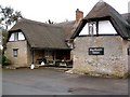
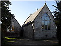
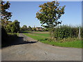
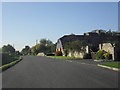
34 photos from this area
Area Information
Key information about the OX29 6XL including its size, population, and administrative classification.
- Area Type
- Postcode
- Area Size
- 6.4 hectares
- Population
- 1431
- Population Density
- 52 people/km²
House Prices in OX29 6XL
20
Properties
£231,890
Average Sold Price
£67,500
Lowest Price
£440,000
Highest Price
Showing 20 properties
| Address | Type | Beds | Baths | Last Sale Price | Last Sale Date | |
|---|---|---|---|---|---|---|
| 19 Lymbrook Close, South Leigh, OX29 6XL | Semi-detached | 4 | 1 | £440,000 | Feb 2023 | |
| 16 Lymbrook Close, South Leigh, OX29 6XL | house | 3 | - | £322,000 | May 2017 | |
| 20 Lymbrook Close, South Leigh, OX29 6XL | Terraced | - | - | £200,000 | May 2008 | |
| 17 Lymbrook Close, South Leigh, OX29 6XL | Terraced | 4 | 1 | £129,950 | Sep 2001 | |
| 18 Lymbrook Close, South Leigh, OX29 6XL | Terraced | - | - | £67,500 | Feb 1999 | |
| 7 Lymbrook Close, South Leigh, OX29 6XL | Terraced | 5 | - | - | - | |
| 5, Lymbrook Cottages, Station Road, South Leigh, OX29 6XL | Semi-detached | 3 | - | - | - | |
| 13 Lymbrook Close, South Leigh, OX29 6XL | Flat | - | - | - | - | |
| 8 Lymbrook Close, South Leigh, OX29 6XL | house | - | - | - | - | |
| 25 Lymbrook Close, South Leigh, OX29 6XL | Bungalow | - | - | - | - |
Page 1 of 2
Energy Efficiency in OX29 6XL
Amenities
Schools
| Rank | School | Type | Entry gender | Ages |
|---|
Explore more schools in this area
Go to Schools tabDemographics
Household Size
Two person
most common
Accommodation Type
Houses
most common
Tenure
53
majority
Ethnic Group
White
most common
Religion
N/A
most common
Household Composition
N/A
most common
Age
47
median
Adults (30-64 years)
most common
Household Deprivation
N/A
with no deprivation
NS-SEC
36
in Lower managerial occupations
Explore more demographic insights in this area
Go to Demographics tabPlanning
Planning Constraints
- Flood RiskPremium
- Ramsar Wetland SitesPremium
- Area of Outstanding Natural BeautyPremium
- Protected Nature ReservePremium
- Protected WoodlandPremium