Area Overview for OX29 6SR
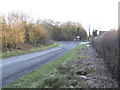
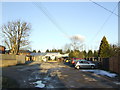
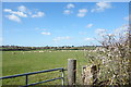
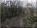
Photos of OX29 6SR


Area Information
Living in OX29 6SR offers a distinctly settled experience for those seeking a quiet, residential enclave. This specific postcode covers a small cluster of homes within Oxfordshire, part of a broader local authority area that encompasses around 40 locations. The area is defined by its low density, with a population of just 2,127 people spread across approximately 15 square kilometres. This results in a modest population density of 141 people per square kilometre. For a prospective buyer, this translates to minimal noise and congestion, creating a tranquil environment ideal for those who value space and privacy. You will find that daily life here moves at a slower pace compared to the urban centres nearby. The area sits comfortably between major towns, offering a rural feel without total isolation. There are no high-rise blocks or dense apartment complexes; instead, the landscape is dominated by detached and semi-detached dwellings spread across green fields and hedgerows. The mix of permanent residents strengthens community bonds, making it easy to recognise neighbours and build local friendships. Whether you are interested in homes in OX29 6SR or exploring the wider Oxfordshire countryside, this locality provides a stable and peaceful foundation for your future. ### The community surrounding OX29 6SR has a clear demographic profile that reflects a mature and established population. The area's median age is 47 years, indicating that the most common age range consists of adults between 30 and 64 years old. You will encounter fewer families with very young children compared to younger suburbs, but the age group typically enjoys financial stability and set careers. Home ownership is a defining feature of this neighbourhood, with 77% of residents owning their property outright or with a mortgage. This high rate suggests a community invested in the long term rather than a transient rental market. The predominant accommodation type consists of houses, which aligns with the owner-occupier statistic and the desire for spacious grounds. The area is predominantly White, reflecting a traditional, homogeneous suburban character common in parts of the south of England. This demographic makes 77% of residents are homeowners. The age profile supports a community where households seek stability and comfort. For someone considering living in OX29 6SR, you can expect to find a society of settled families and professionals who value their local environment. The lack of younger children in the primary age brackets may limit day-to-day noise but ensures quiet streets and parks. ### The property market in OX29 6SR is characterised by a strong emphasis on private residence rather than renting. With 77% of households owning their homes, the area functions primarily as an owner-occupied neighbourhood. This statistic indicates that the local market is driven by buyers looking to settle down and build equity. Consequently, the housing stock is dominated by houses, which serve as the predominant accommodation type. You will find few purpose-built rental flats or social housing alongside the traditional residential structures. This dynamic means that purchasing a home here involves joining an established group of residents who have likely been there for years. For buyers focused on homes in OX29 6SR, the high ownership rate suggests a stable market with limited fluctuation compared to high-turnover city centres. The majority of transactions involve existing homeowners moving. The scarcity of rental properties correlates with the 77% ownership figure, making this an area where securing a tenancy is less common than finding a purchase. If you are looking to buy a house with garden space in a low-density setting, this market structure supports that desire. The 141 people per square kilometre density further reinforces the suitability for houses over apartments. ### Families considering OX29 6SR have access to a small but varied selection of educational institutions within practical reach. The nearest community school is North Leigh Church of England (Controlled) School, which stands as the local primary option. Further afield, Scott's House School operates as an independent institution, providing an alternative for parents seeking a private education. For pupils requiring secondary education, North Leigh Church of England School, which functions as an academy, holds a "good" Ofsted rating. This assessment confirms a level of educational standards that meets regulatory expectations. The mix of controlled, independent, and academy schools means that prospective parents have options ranging from state-sector accountability to private independence. A "good" rating at the academy level indicates reliable teaching and management. When looking at schools near OX29 6SR, you will see these three distinct entities form the immediate network. This variety allows families to choose an educational style that fits their specific needs while remaining within the local cluster. The proximity of these institutions to the residential cluster supports the area's family-friendly reputation. North Leigh Church of England School being an academy adds a layer of contemporary educational governance to the local choices. ### Digital connectivity in OX29 6SR is robust, supporting both remote work and daily internet-intensive activities without typical rural compromises. Your fixed broadband connection scores a 95 out of 100, classifying the speed and reliability as excellent. This near-perfect score ensures that video conferencing, large file transfers, and streaming services function smoothly. You can work from home with confidence, knowing your internet performance rivals urban environments. Mobile coverage is also strong, with a score of 82 out of 100. This rating denotes a good to excellent service for voice calls and data on your smartphone. Whether you are in a garden or driving between towns, maintaining a connection is highly reliable. For a location with a population of just 2,127, these figures represent a significant advantage over many other rural postcodes. The combination of a 95 broadband score and an 82 mobile coverage score means that living in OX29 6SR does not require a sacrifice of digital lifestyle. Residents do not face the lag or dropouts often associated with remote areas. This level of connectivity makes the area suitable for digital nomads, remote employees, and families reliant on modern communication tools. ### Your daily convenience in OX29 6SR relies on a network of amenities within a short practical drive. For retail needs, you have five key options nearby, including the Co-op on Long, Co-op on Madley, and Budgens in Witney. These supermarkets cover your weekly shopping requirements alongside specialist grocery shopping. Transport links are accessible through four railway stations, notably Combe, Hanborough, and Finstock Railway Station. These stations connect you to broader rail networks for commuting or holidays. Nearby airports including Oxford (Kidlington) Airport and London Oxford Airport provide quick access for flights. This proximity reduces travel time significantly compared to driving to major hubs. The area's lifestyle is defined by this accessible but calm environment. While you enjoy the peace of a small residence, you can reach essential services without spending hours in traffic. The presence of Co-op stores and major retailers like Budgens means you do not need to travel far for groceries. Railway access at Combe, Hanborough, and Finstock ensures you can leave quickly if needed. For residents of OX29 6SR, this balance means a quiet home life with immediate access to the wider region. The five retail outlets and four rail stations create a sufficient support circle for practical living. ### Safety assessments for OX29 6SR highlight a secure environment with minimal environmental risks. The area passes all key planning and safety checks with flying colours, presenting no significant constraints to living here. Flood risk is rated as low, meaning the likelihood of your property suffering water damage is negligible. The safety score regarding this specific risk is 0 out of 100, indicating a clean track record. Likewise, there is no Ramsar wetland site coverage, and the area does not fall within an Area of Outstanding Natural Beauty or protected nature reserve boundaries. These null scores simplify the planning process for future works or extensions. Protected woodland coverage is also absent, removing further layers of restriction. Most notably for residents, the crime risk score is 79 out of 100. This score signifies a low crime risk compared to national averages. You are statistically less likely to be a victim of crime here than in many other urban locations. The safety score confirms that OX29 6SR is a secure neighbourhood. All assessments pass with a score of 0 for environmental factors. This has passed every check. The passing grades across flood, planning constraints, and nature reserves show a low-risk location. The 79 crime risk score means you can leave your home with confidence. ### **Who typically lives in OX29 6SR and what is the community feel like?The area is home to 2,127 people across 15 square kilometres, resulting in a population density of 141 people per square kilometre. The median age is 47, with adults aged 30 to 64 forming the majority. High home ownership at 77% creates a settled, owner-occupied community focused on long-term residence.** **What schools are available nearby for families in OX29 6SR?Local families have access to North Leigh Church of England School (academy) with a "good" Ofsted rating for secondary education. Primary provision includes North Leigh Church of England (Controlled) School. Scott's House School offers an independent option for those seeking private education within the cluster.** **How are transport and digital connectivity for working from home in this area?Digital infrastructure is excellent, with a fixed broadband score of 95 and mobile coverage of 82 out of 100. Transport links include four railways, with stations at Combe, Hanborough, and Finstock, plus proximity to Oxford (Kidlington) and London Oxford airports.** **Is OX29 6SR a safe place to live regarding crime and environmental risks?The area scores a 79 out of 100 for low crime risk, indicating safer rates than average. Environmental assessments show zero risk for flooding, Ramsar sites, AONBs, and protected nature reserves, ensuring no planning constraints for residents.** **Can I access amenities and shops without needing to travel far?Yes, five retail outlets are nearby, including Co-op on Long, Co-op on Madley, and Budgens in Witney. Residents can easily reach these shop destinations from their homes in OX29 6SR.
- Area Type
- Postcode
- Area Size
- Not available
- Population
- 2127
- Population Density
- 141 people/km²
The property market in OX29 6SR is characterised by a strong emphasis on private residence rather than renting. With 77% of households owning their homes, the area functions primarily as an owner-occupied neighbourhood. This statistic indicates that the local market is driven by buyers looking to settle down and build equity. Consequently, the housing stock is dominated by houses, which serve as the predominant accommodation type. You will find few purpose-built rental flats or social housing alongside the traditional residential structures. This dynamic means that purchasing a home here involves joining an established group of residents who have likely been there for years. For buyers focused on homes in OX29 6SR, the high ownership rate suggests a stable market with limited fluctuation compared to high-turnover city centres. The majority of transactions involve existing homeowners moving. The scarcity of rental properties correlates with the 77% ownership figure, making this an area where securing a tenancy is less common than finding a purchase. If you are looking to buy a house with garden space in a low-density setting, this market structure supports that desire. The 141 people per square kilometre density further reinforces the suitability for houses over apartments. ### Families considering OX29 6SR have access to a small but varied selection of educational institutions within practical reach. The nearest community school is North Leigh Church of England (Controlled) School, which stands as the local primary option. Further afield, Scott's House School operates as an independent institution, providing an alternative for parents seeking a private education. For pupils requiring secondary education, North Leigh Church of England School, which functions as an academy, holds a "good" Ofsted rating. This assessment confirms a level of educational standards that meets regulatory expectations. The mix of controlled, independent, and academy schools means that prospective parents have options ranging from state-sector accountability to private independence. A "good" rating at the academy level indicates reliable teaching and management. When looking at schools near OX29 6SR, you will see these three distinct entities form the immediate network. This variety allows families to choose an educational style that fits their specific needs while remaining within the local cluster. The proximity of these institutions to the residential cluster supports the area's family-friendly reputation. North Leigh Church of England School being an academy adds a layer of contemporary educational governance to the local choices. ### Digital connectivity in OX29 6SR is robust, supporting both remote work and daily internet-intensive activities without typical rural compromises. Your fixed broadband connection scores a 95 out of 100, classifying the speed and reliability as excellent. This near-perfect score ensures that video conferencing, large file transfers, and streaming services function smoothly. You can work from home with confidence, knowing your internet performance rivals urban environments. Mobile coverage is also strong, with a score of 82 out of 100. This rating denotes a good to excellent service for voice calls and data on your smartphone. Whether you are in a garden or driving between towns, maintaining a connection is highly reliable. For a location with a population of just 2,127, these figures represent a significant advantage over many other rural postcodes. The combination of a 95 broadband score and an 82 mobile coverage score means that living in OX29 6SR does not require a sacrifice of digital lifestyle. Residents do not face the lag or dropouts often associated with remote areas. This level of connectivity makes the area suitable for digital nomads, remote employees, and families reliant on modern communication tools. ### Your daily convenience in OX29 6SR relies on a network of amenities within a short practical drive. For retail needs, you have five key options nearby, including the Co-op on Long, Co-op on Madley, and Budgens in Witney. These supermarkets cover your weekly shopping requirements alongside specialist grocery shopping. Transport links are accessible through four railway stations, notably Combe, Hanborough, and Finstock Railway Station. These stations connect you to broader rail networks for commuting or holidays. Nearby airports including Oxford (Kidlington) Airport and London Oxford Airport provide quick access for flights. This proximity reduces travel time significantly compared to driving to major hubs. The area's lifestyle is defined by this accessible but calm environment. While you enjoy the peace of a small residence, you can reach essential services without spending hours in traffic. The presence of Co-op stores and major retailers like Budgens means you do not need to travel far for groceries. Railway access at Combe, Hanborough, and Finstock ensures you can leave quickly if needed. For residents of OX29 6SR, this balance means a quiet home life with immediate access to the wider region. The five retail outlets and four rail stations create a sufficient support circle for practical living. ### Safety assessments for OX29 6SR highlight a secure environment with minimal environmental risks. The area passes all key planning and safety checks with flying colours, presenting no significant constraints to living here. Flood risk is rated as low, meaning the likelihood of your property suffering water damage is negligible. The safety score regarding this specific risk is 0 out of 100, indicating a clean track record. Likewise, there is no Ramsar wetland site coverage, and the area does not fall within an Area of Outstanding Natural Beauty or protected nature reserve boundaries. These null scores simplify the planning process for future works or extensions. Protected woodland coverage is also absent, removing further layers of restriction. Most notably for residents, the crime risk score is 79 out of 100. This score signifies a low crime risk compared to national averages. You are statistically less likely to be a victim of crime here than in many other urban locations. The safety score confirms that OX29 6SR is a secure neighbourhood. All assessments pass with a score of 0 for environmental factors. This has passed every check. The passing grades across flood, planning constraints, and nature reserves show a low-risk location. The 79 crime risk score means you can leave your home with confidence. ### **Who typically lives in OX29 6SR and what is the community feel like?The area is home to 2,127 people across 15 square kilometres, resulting in a population density of 141 people per square kilometre. The median age is 47, with adults aged 30 to 64 forming the majority. High home ownership at 77% creates a settled, owner-occupied community focused on long-term residence.** **What schools are available nearby for families in OX29 6SR?Local families have access to North Leigh Church of England School (academy) with a "good" Ofsted rating for secondary education. Primary provision includes North Leigh Church of England (Controlled) School. Scott's House School offers an independent option for those seeking private education within the cluster.** **How are transport and digital connectivity for working from home in this area?Digital infrastructure is excellent, with a fixed broadband score of 95 and mobile coverage of 82 out of 100. Transport links include four railways, with stations at Combe, Hanborough, and Finstock, plus proximity to Oxford (Kidlington) and London Oxford airports.** **Is OX29 6SR a safe place to live regarding crime and environmental risks?The area scores a 79 out of 100 for low crime risk, indicating safer rates than average. Environmental assessments show zero risk for flooding, Ramsar sites, AONBs, and protected nature reserves, ensuring no planning constraints for residents.** **Can I access amenities and shops without needing to travel far?Yes, five retail outlets are nearby, including Co-op on Long, Co-op on Madley, and Budgens in Witney. Residents can easily reach these shop destinations from their homes in OX29 6SR.
House Prices in OX29 6SR
No properties found in this postcode.
Energy Efficiency in OX29 6SR
Your daily convenience in OX29 6SR relies on a network of amenities within a short practical drive. For retail needs, you have five key options nearby, including the Co-op on Long, Co-op on Madley, and Budgens in Witney. These supermarkets cover your weekly shopping requirements alongside specialist grocery shopping. Transport links are accessible through four railway stations, notably Combe, Hanborough, and Finstock Railway Station. These stations connect you to broader rail networks for commuting or holidays. Nearby airports including Oxford (Kidlington) Airport and London Oxford Airport provide quick access for flights. This proximity reduces travel time significantly compared to driving to major hubs. The area's lifestyle is defined by this accessible but calm environment. While you enjoy the peace of a small residence, you can reach essential services without spending hours in traffic. The presence of Co-op stores and major retailers like Budgens means you do not need to travel far for groceries. Railway access at Combe, Hanborough, and Finstock ensures you can leave quickly if needed. For residents of OX29 6SR, this balance means a quiet home life with immediate access to the wider region. The five retail outlets and four rail stations create a sufficient support circle for practical living. ### Safety assessments for OX29 6SR highlight a secure environment with minimal environmental risks. The area passes all key planning and safety checks with flying colours, presenting no significant constraints to living here. Flood risk is rated as low, meaning the likelihood of your property suffering water damage is negligible. The safety score regarding this specific risk is 0 out of 100, indicating a clean track record. Likewise, there is no Ramsar wetland site coverage, and the area does not fall within an Area of Outstanding Natural Beauty or protected nature reserve boundaries. These null scores simplify the planning process for future works or extensions. Protected woodland coverage is also absent, removing further layers of restriction. Most notably for residents, the crime risk score is 79 out of 100. This score signifies a low crime risk compared to national averages. You are statistically less likely to be a victim of crime here than in many other urban locations. The safety score confirms that OX29 6SR is a secure neighbourhood. All assessments pass with a score of 0 for environmental factors. This has passed every check. The passing grades across flood, planning constraints, and nature reserves show a low-risk location. The 79 crime risk score means you can leave your home with confidence. ### **Who typically lives in OX29 6SR and what is the community feel like?The area is home to 2,127 people across 15 square kilometres, resulting in a population density of 141 people per square kilometre. The median age is 47, with adults aged 30 to 64 forming the majority. High home ownership at 77% creates a settled, owner-occupied community focused on long-term residence.** **What schools are available nearby for families in OX29 6SR?Local families have access to North Leigh Church of England School (academy) with a "good" Ofsted rating for secondary education. Primary provision includes North Leigh Church of England (Controlled) School. Scott's House School offers an independent option for those seeking private education within the cluster.** **How are transport and digital connectivity for working from home in this area?Digital infrastructure is excellent, with a fixed broadband score of 95 and mobile coverage of 82 out of 100. Transport links include four railways, with stations at Combe, Hanborough, and Finstock, plus proximity to Oxford (Kidlington) and London Oxford airports.** **Is OX29 6SR a safe place to live regarding crime and environmental risks?The area scores a 79 out of 100 for low crime risk, indicating safer rates than average. Environmental assessments show zero risk for flooding, Ramsar sites, AONBs, and protected nature reserves, ensuring no planning constraints for residents.** **Can I access amenities and shops without needing to travel far?Yes, five retail outlets are nearby, including Co-op on Long, Co-op on Madley, and Budgens in Witney. Residents can easily reach these shop destinations from their homes in OX29 6SR.
Amenities
Schools
Families considering OX29 6SR have access to a small but varied selection of educational institutions within practical reach. The nearest community school is North Leigh Church of England (Controlled) School, which stands as the local primary option. Further afield, Scott's House School operates as an independent institution, providing an alternative for parents seeking a private education. For pupils requiring secondary education, North Leigh Church of England School, which functions as an academy, holds a "good" Ofsted rating. This assessment confirms a level of educational standards that meets regulatory expectations. The mix of controlled, independent, and academy schools means that prospective parents have options ranging from state-sector accountability to private independence. A "good" rating at the academy level indicates reliable teaching and management. When looking at schools near OX29 6SR, you will see these three distinct entities form the immediate network. This variety allows families to choose an educational style that fits their specific needs while remaining within the local cluster. The proximity of these institutions to the residential cluster supports the area's family-friendly reputation. North Leigh Church of England School being an academy adds a layer of contemporary educational governance to the local choices. ### Digital connectivity in OX29 6SR is robust, supporting both remote work and daily internet-intensive activities without typical rural compromises. Your fixed broadband connection scores a 95 out of 100, classifying the speed and reliability as excellent. This near-perfect score ensures that video conferencing, large file transfers, and streaming services function smoothly. You can work from home with confidence, knowing your internet performance rivals urban environments. Mobile coverage is also strong, with a score of 82 out of 100. This rating denotes a good to excellent service for voice calls and data on your smartphone. Whether you are in a garden or driving between towns, maintaining a connection is highly reliable. For a location with a population of just 2,127, these figures represent a significant advantage over many other rural postcodes. The combination of a 95 broadband score and an 82 mobile coverage score means that living in OX29 6SR does not require a sacrifice of digital lifestyle. Residents do not face the lag or dropouts often associated with remote areas. This level of connectivity makes the area suitable for digital nomads, remote employees, and families reliant on modern communication tools. ### Your daily convenience in OX29 6SR relies on a network of amenities within a short practical drive. For retail needs, you have five key options nearby, including the Co-op on Long, Co-op on Madley, and Budgens in Witney. These supermarkets cover your weekly shopping requirements alongside specialist grocery shopping. Transport links are accessible through four railway stations, notably Combe, Hanborough, and Finstock Railway Station. These stations connect you to broader rail networks for commuting or holidays. Nearby airports including Oxford (Kidlington) Airport and London Oxford Airport provide quick access for flights. This proximity reduces travel time significantly compared to driving to major hubs. The area's lifestyle is defined by this accessible but calm environment. While you enjoy the peace of a small residence, you can reach essential services without spending hours in traffic. The presence of Co-op stores and major retailers like Budgens means you do not need to travel far for groceries. Railway access at Combe, Hanborough, and Finstock ensures you can leave quickly if needed. For residents of OX29 6SR, this balance means a quiet home life with immediate access to the wider region. The five retail outlets and four rail stations create a sufficient support circle for practical living. ### Safety assessments for OX29 6SR highlight a secure environment with minimal environmental risks. The area passes all key planning and safety checks with flying colours, presenting no significant constraints to living here. Flood risk is rated as low, meaning the likelihood of your property suffering water damage is negligible. The safety score regarding this specific risk is 0 out of 100, indicating a clean track record. Likewise, there is no Ramsar wetland site coverage, and the area does not fall within an Area of Outstanding Natural Beauty or protected nature reserve boundaries. These null scores simplify the planning process for future works or extensions. Protected woodland coverage is also absent, removing further layers of restriction. Most notably for residents, the crime risk score is 79 out of 100. This score signifies a low crime risk compared to national averages. You are statistically less likely to be a victim of crime here than in many other urban locations. The safety score confirms that OX29 6SR is a secure neighbourhood. All assessments pass with a score of 0 for environmental factors. This has passed every check. The passing grades across flood, planning constraints, and nature reserves show a low-risk location. The 79 crime risk score means you can leave your home with confidence. ### **Who typically lives in OX29 6SR and what is the community feel like?The area is home to 2,127 people across 15 square kilometres, resulting in a population density of 141 people per square kilometre. The median age is 47, with adults aged 30 to 64 forming the majority. High home ownership at 77% creates a settled, owner-occupied community focused on long-term residence.** **What schools are available nearby for families in OX29 6SR?Local families have access to North Leigh Church of England School (academy) with a "good" Ofsted rating for secondary education. Primary provision includes North Leigh Church of England (Controlled) School. Scott's House School offers an independent option for those seeking private education within the cluster.** **How are transport and digital connectivity for working from home in this area?Digital infrastructure is excellent, with a fixed broadband score of 95 and mobile coverage of 82 out of 100. Transport links include four railways, with stations at Combe, Hanborough, and Finstock, plus proximity to Oxford (Kidlington) and London Oxford airports.** **Is OX29 6SR a safe place to live regarding crime and environmental risks?The area scores a 79 out of 100 for low crime risk, indicating safer rates than average. Environmental assessments show zero risk for flooding, Ramsar sites, AONBs, and protected nature reserves, ensuring no planning constraints for residents.** **Can I access amenities and shops without needing to travel far?Yes, five retail outlets are nearby, including Co-op on Long, Co-op on Madley, and Budgens in Witney. Residents can easily reach these shop destinations from their homes in OX29 6SR.
| Rank | School | Type | Entry gender | Ages |
|---|
Explore more schools in this area
Go to Schools tabDemographics
The community surrounding OX29 6SR has a clear demographic profile that reflects a mature and established population. The area's median age is 47 years, indicating that the most common age range consists of adults between 30 and 64 years old. You will encounter fewer families with very young children compared to younger suburbs, but the age group typically enjoys financial stability and set careers. Home ownership is a defining feature of this neighbourhood, with 77% of residents owning their property outright or with a mortgage. This high rate suggests a community invested in the long term rather than a transient rental market. The predominant accommodation type consists of houses, which aligns with the owner-occupier statistic and the desire for spacious grounds. The area is predominantly White, reflecting a traditional, homogeneous suburban character common in parts of the south of England. This demographic makes 77% of residents are homeowners. The age profile supports a community where households seek stability and comfort. For someone considering living in OX29 6SR, you can expect to find a society of settled families and professionals who value their local environment. The lack of younger children in the primary age brackets may limit day-to-day noise but ensures quiet streets and parks. ### The property market in OX29 6SR is characterised by a strong emphasis on private residence rather than renting. With 77% of households owning their homes, the area functions primarily as an owner-occupied neighbourhood. This statistic indicates that the local market is driven by buyers looking to settle down and build equity. Consequently, the housing stock is dominated by houses, which serve as the predominant accommodation type. You will find few purpose-built rental flats or social housing alongside the traditional residential structures. This dynamic means that purchasing a home here involves joining an established group of residents who have likely been there for years. For buyers focused on homes in OX29 6SR, the high ownership rate suggests a stable market with limited fluctuation compared to high-turnover city centres. The majority of transactions involve existing homeowners moving. The scarcity of rental properties correlates with the 77% ownership figure, making this an area where securing a tenancy is less common than finding a purchase. If you are looking to buy a house with garden space in a low-density setting, this market structure supports that desire. The 141 people per square kilometre density further reinforces the suitability for houses over apartments. ### Families considering OX29 6SR have access to a small but varied selection of educational institutions within practical reach. The nearest community school is North Leigh Church of England (Controlled) School, which stands as the local primary option. Further afield, Scott's House School operates as an independent institution, providing an alternative for parents seeking a private education. For pupils requiring secondary education, North Leigh Church of England School, which functions as an academy, holds a "good" Ofsted rating. This assessment confirms a level of educational standards that meets regulatory expectations. The mix of controlled, independent, and academy schools means that prospective parents have options ranging from state-sector accountability to private independence. A "good" rating at the academy level indicates reliable teaching and management. When looking at schools near OX29 6SR, you will see these three distinct entities form the immediate network. This variety allows families to choose an educational style that fits their specific needs while remaining within the local cluster. The proximity of these institutions to the residential cluster supports the area's family-friendly reputation. North Leigh Church of England School being an academy adds a layer of contemporary educational governance to the local choices. ### Digital connectivity in OX29 6SR is robust, supporting both remote work and daily internet-intensive activities without typical rural compromises. Your fixed broadband connection scores a 95 out of 100, classifying the speed and reliability as excellent. This near-perfect score ensures that video conferencing, large file transfers, and streaming services function smoothly. You can work from home with confidence, knowing your internet performance rivals urban environments. Mobile coverage is also strong, with a score of 82 out of 100. This rating denotes a good to excellent service for voice calls and data on your smartphone. Whether you are in a garden or driving between towns, maintaining a connection is highly reliable. For a location with a population of just 2,127, these figures represent a significant advantage over many other rural postcodes. The combination of a 95 broadband score and an 82 mobile coverage score means that living in OX29 6SR does not require a sacrifice of digital lifestyle. Residents do not face the lag or dropouts often associated with remote areas. This level of connectivity makes the area suitable for digital nomads, remote employees, and families reliant on modern communication tools. ### Your daily convenience in OX29 6SR relies on a network of amenities within a short practical drive. For retail needs, you have five key options nearby, including the Co-op on Long, Co-op on Madley, and Budgens in Witney. These supermarkets cover your weekly shopping requirements alongside specialist grocery shopping. Transport links are accessible through four railway stations, notably Combe, Hanborough, and Finstock Railway Station. These stations connect you to broader rail networks for commuting or holidays. Nearby airports including Oxford (Kidlington) Airport and London Oxford Airport provide quick access for flights. This proximity reduces travel time significantly compared to driving to major hubs. The area's lifestyle is defined by this accessible but calm environment. While you enjoy the peace of a small residence, you can reach essential services without spending hours in traffic. The presence of Co-op stores and major retailers like Budgens means you do not need to travel far for groceries. Railway access at Combe, Hanborough, and Finstock ensures you can leave quickly if needed. For residents of OX29 6SR, this balance means a quiet home life with immediate access to the wider region. The five retail outlets and four rail stations create a sufficient support circle for practical living. ### Safety assessments for OX29 6SR highlight a secure environment with minimal environmental risks. The area passes all key planning and safety checks with flying colours, presenting no significant constraints to living here. Flood risk is rated as low, meaning the likelihood of your property suffering water damage is negligible. The safety score regarding this specific risk is 0 out of 100, indicating a clean track record. Likewise, there is no Ramsar wetland site coverage, and the area does not fall within an Area of Outstanding Natural Beauty or protected nature reserve boundaries. These null scores simplify the planning process for future works or extensions. Protected woodland coverage is also absent, removing further layers of restriction. Most notably for residents, the crime risk score is 79 out of 100. This score signifies a low crime risk compared to national averages. You are statistically less likely to be a victim of crime here than in many other urban locations. The safety score confirms that OX29 6SR is a secure neighbourhood. All assessments pass with a score of 0 for environmental factors. This has passed every check. The passing grades across flood, planning constraints, and nature reserves show a low-risk location. The 79 crime risk score means you can leave your home with confidence. ### **Who typically lives in OX29 6SR and what is the community feel like?The area is home to 2,127 people across 15 square kilometres, resulting in a population density of 141 people per square kilometre. The median age is 47, with adults aged 30 to 64 forming the majority. High home ownership at 77% creates a settled, owner-occupied community focused on long-term residence.** **What schools are available nearby for families in OX29 6SR?Local families have access to North Leigh Church of England School (academy) with a "good" Ofsted rating for secondary education. Primary provision includes North Leigh Church of England (Controlled) School. Scott's House School offers an independent option for those seeking private education within the cluster.** **How are transport and digital connectivity for working from home in this area?Digital infrastructure is excellent, with a fixed broadband score of 95 and mobile coverage of 82 out of 100. Transport links include four railways, with stations at Combe, Hanborough, and Finstock, plus proximity to Oxford (Kidlington) and London Oxford airports.** **Is OX29 6SR a safe place to live regarding crime and environmental risks?The area scores a 79 out of 100 for low crime risk, indicating safer rates than average. Environmental assessments show zero risk for flooding, Ramsar sites, AONBs, and protected nature reserves, ensuring no planning constraints for residents.** **Can I access amenities and shops without needing to travel far?Yes, five retail outlets are nearby, including Co-op on Long, Co-op on Madley, and Budgens in Witney. Residents can easily reach these shop destinations from their homes in OX29 6SR.
Household Size
Accommodation Type
Tenure
Ethnic Group
Religion
Household Composition
Age
Household Deprivation
NS-SEC
Explore more demographic insights in this area
Go to Demographics tabPlanning
Planning Constraints
- Flood RiskPremium
- Ramsar Wetland SitesPremium
- Area of Outstanding Natural BeautyPremium
- Protected Nature ReservePremium
- Protected WoodlandPremium