Area Overview for OX29 6SB
Photos of OX29 6SB
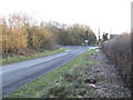
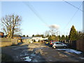
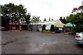

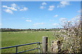
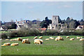
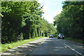
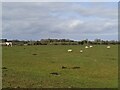
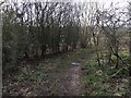

11 photos from this area
Area Information
Key information about the OX29 6SB including its size, population, and administrative classification.
- Area Type
- Postcode
- Area Size
- 2.1 hectares
- Population
- 2127
- Population Density
- 141 people/km²
House Prices in OX29 6SB
22
Properties
£271,063
Average Sold Price
£6,000
Lowest Price
£575,000
Highest Price
Showing 22 properties
| Address | Type | Beds | Baths | Last Sale Price | Last Sale Date | |
|---|---|---|---|---|---|---|
| 69 Park Road, North Leigh, OX29 6SB | house | - | - | £575,000 | Aug 2023 | |
| 107A Park Road, North Leigh, OX29 6SB | Detached | - | - | £6,000 | Jun 2021 | |
| Flowerdale Cottage, 77 Park Road, North Leigh, OX29 6SB | house | 2 | 1 | £315,000 | Feb 2021 | |
| 71 Park Road, North Leigh, OX29 6SB | Bungalow | 3 | 1 | £327,500 | Jun 2020 | |
| Wychwood, 65 Park Road, North Leigh, OX29 6SB | Detached | 4 | 1 | £415,000 | Nov 2018 | |
| 91 Park Road, North Leigh, OX29 6SB | Terraced | 3 | 1 | £287,500 | Mar 2018 | |
| 75 Park Road, North Leigh, OX29 6SB | Semi-detached | 3 | 2 | £230,000 | Aug 2016 | |
| 97 Park Road, North Leigh, OX29 6SB | house | 3 | 1 | £263,000 | Jun 2015 | |
| The Village Farmhouse, 73 Park Road, North Leigh, OX29 6SB | Detached | 5 | - | £499,950 | Apr 2010 | |
| 67 Park Road, North Leigh, OX29 6SB | Terraced | 3 | - | £271,500 | Sep 2006 |
Page 1 of 3
Energy Efficiency in OX29 6SB
Amenities
Schools
| Rank | School | Type | Entry gender | Ages |
|---|
Explore more schools in this area
Go to Schools tabDemographics
Household Size
Two person
most common
Accommodation Type
Houses
most common
Tenure
77
majority
Ethnic Group
White
most common
Religion
N/A
most common
Household Composition
N/A
most common
Age
47
median
Adults (30-64 years)
most common
Household Deprivation
N/A
with no deprivation
NS-SEC
42
in Lower managerial occupations
Explore more demographic insights in this area
Go to Demographics tabPlanning
Planning Constraints
- Flood RiskPremium
- Ramsar Wetland SitesPremium
- Area of Outstanding Natural BeautyPremium
- Protected Nature ReservePremium
- Protected WoodlandPremium