Area Overview for OX29 4QW
Photos of OX29 4QW
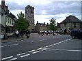
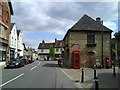
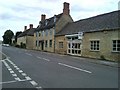
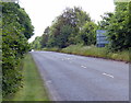
100 photos from this area
Area Information
Key information about the OX29 4QW including its size, population, and administrative classification.
- Area Type
- Postcode
- Area Size
- 2.5 hectares
- Population
- 1444
- Population Density
- 3977 people/km²
House Prices in OX29 4QW
29
Properties
£267,365
Average Sold Price
£87,950
Lowest Price
£590,000
Highest Price
Showing 29 properties
| Address | Type | Beds | Baths | Last Sale Price | Last Sale Date | |
|---|---|---|---|---|---|---|
| Mickeysands, 44 Back Lane, Eynsham, OX29 4QW | Detached | 3 | 1 | £475,000 | Nov 2025 | |
| 34 Back Lane, Eynsham, OX29 4QW | Detached | 4 | 2 | £590,000 | Aug 2021 | |
| 40 Back Lane, Eynsham, OX29 4QW | Bungalow | 3 | 1 | £419,950 | Jul 2020 | |
| 14 Back Lane, Eynsham, OX29 4QW | Terraced | 3 | - | £266,000 | Jul 2015 | |
| 52 Back Lane, Eynsham, OX29 4QW | Semi-detached | 3 | 1 | £260,000 | Aug 2014 | |
| 18 Back Lane, Eynsham, OX29 4QW | house | - | - | £223,000 | Mar 2012 | |
| 8 Back Lane, Eynsham, OX29 4QW | Terraced | - | - | £214,950 | Jan 2008 | |
| 30 Back Lane, Eynsham, OX29 4QW | Bungalow | - | - | £299,950 | Mar 2005 | |
| 12 Back Lane, Eynsham, OX29 4QW | Terraced | - | - | £187,000 | Aug 2004 | |
| 22 Back Lane, Eynsham, OX29 4QW | Terraced | - | - | £159,950 | Aug 2000 |
Page 1 of 3
Energy Efficiency in OX29 4QW
Amenities
Schools
| Rank | School | Type | Entry gender | Ages |
|---|
Explore more schools in this area
Go to Schools tabDemographics
Household Size
Two person
most common
Accommodation Type
Houses
most common
Tenure
81
majority
Ethnic Group
White
most common
Religion
N/A
most common
Household Composition
N/A
most common
Age
47
median
Adults (30-64 years)
most common
Household Deprivation
N/A
with no deprivation
NS-SEC
40
in Lower managerial occupations
Explore more demographic insights in this area
Go to Demographics tabPlanning
Planning Constraints
- Flood RiskPremium
- Ramsar Wetland SitesPremium
- Area of Outstanding Natural BeautyPremium
- Protected Nature ReservePremium
- Protected WoodlandPremium