Area Overview for OX29 4LY
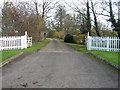
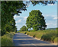
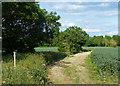
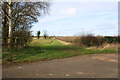
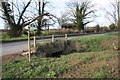
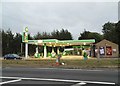
Photos of OX29 4LY


Area Information
Living in OX29 4LY defines a specific residential experience within a very compact footprint. This postcode covers only 1.2 hectares, creating an environment where the community feels immediately close-knit. Despite its modest size, approximately 1,574 residents call this location home, resulting in a high population density of 131,808 people per square kilometre. The area sits primarily within Oxfordshire, offering a setting that balances urban accessibility with a concentrated neighbourhood feel. You will find yourself in a zone where footpaths and small streets link directly to the surrounding serviced areas without the sprawl of larger districts. Daily life here is characterised by the presence of established homes rather than development plots. The high density suggests a village-style atmosphere where neighbours interact frequently. For those considering OX29 4LY, the sheer compactness means that facilities in the wider Eynsham region are technically just a short drive or walk away. The area functions as a stable residential cluster rather than a business hub or mixed-use zone. Buyers looking for a defined, small-scale living environment will find this postcode offers a precise slice of life.
- Area Type
- Postcode
- Area Size
- 1.2 hectares
- Population
- 1574
- Population Density
- 5548 people/km²
The property market in OX29 4LY is defined by a strong preference for ownership and traditional housing stock. With 71% home ownership, the area functions primarily as a market for buyers looking to purchase, rather than a hub for rental properties or student accommodation. This statistic indicates that the prevailing sentiment is one of residence and commitment to the location. The accommodation type is listed as houses, which suggests a streetscape built for permanent family living rather than transient housing solutions. You will likely find detached, semi-detached, or terraced homes that have weathered decades of local conditions. This high ownership rate often drives a slower, more deliberate selling process as vendors tend to hold onto properties longer. Buyers searching for homes in OX29 4LY will be competing within a pool of owner-occupied estates rather than grading down from a high-rental sector. The density of 131,808 people per square kilometre is unusually high for this type of accommodation, implying that the land use is maximised efficiently. If you are looking to buy, expect a market where prices reflect the stability and ownership惯性 of the neighbourhood.
House Prices in OX29 4LY
Showing 19 properties
| Address | Type | Beds | Baths | Last Sale Price | Last Sale Date | |
|---|---|---|---|---|---|---|
| 57 Wytham View, Eynsham, OX29 4LY | house | - | - | £425,000 | Jun 2021 | |
| 65 Wytham View, Eynsham, OX29 4LY | Semi-detached | 2 | 1 | £250,000 | Apr 2020 | |
| 71 Wytham View, Eynsham, OX29 4LY | Terraced | 3 | 1 | £346,500 | Nov 2019 | |
| 73 Wytham View, Eynsham, OX29 4LY | Terraced | 4 | 2 | £342,500 | Apr 2016 | |
| 79 Wytham View, Eynsham, OX29 4LY | house | - | - | £289,000 | Nov 2015 | |
| 63 Wytham View, Eynsham, OX29 4LY | Semi-detached | 3 | - | £247,000 | Jul 2013 | |
| 55 Wytham View, Eynsham, OX29 4LY | house | 2 | 1 | £202,000 | May 2010 | |
| 53 Wytham View, Eynsham, OX29 4LY | Terraced | - | - | £98,000 | Dec 1999 | |
| 53A Wytham View, Eynsham, OX29 4LY | Terraced | 3 | 2 | - | - | |
| 81 Wytham View, Eynsham, OX29 4LY | house | - | - | - | - |
Energy Efficiency in OX29 4LY
Your lifestyle in OX29 4LY is dictated by proximity to the amenities in neighbouring Eynsham, which are within practical reach. The area provides immediate access to five retail outlets, including Tesco Eynsham, Spar, and Co-op Eynsham. These specific venues handle grocery shopping, pharmacy needs, and everyday essentials, removing the necessity for frequent long journeys. Rail travel is accessible through a network of four stations, including Hanborough Railway Station, Combe Railway Station, and Oxford Parkway Railway Station. This gradient of options allows you to choose between stopping off points and the major interchange at Oxford Parkway. Aviation options are also nearby with London Oxford Airport and Oxford (Kidlington) Airport listed for business or private travel needs. While these airports are not within walking distance from the postcode, they are noted as accessible destinations for residents who utilise air travel. The convenience of having specific named shops and transport hubs nearby means that leisure and errands are consolidated into efficient trips. You can complete your weekly shop or catch a train without venture far beyond the immediate community boundary.
Amenities
Schools
Families considering schools near OX29 4LY have one specific primary option listed in your immediate vicinity. Eynsham Community Primary School serves as the designated primary institution for the area. This school holds a 'good' Ofsted rating, indicating it meets the required standards for educational provision and student support. With no secondary schools or further education colleges listed in the immediate data, families typically commute to nearby towns for older students. The presence of a rated primary school suggests that the local infrastructure supports early childhood education adequately. For residents of OX29 4LY, the journey to school will likely involve the commute to the single available primary option. The school's designation as a community primary implies a focus on local catchment areas rather than international admissions. This setup works well for families who have settled in the OX29 4LY cluster and wish to keep their children within the local transport radius. The consistent rating provides parents with confidence in the institution they will be supporting.
| Rank | School | Type | Entry gender | Ages |
|---|
Explore more schools in this area
Go to Schools tabDemographics
The community within OX29 4LY reflects a mature population structure. The median age stands at 47 years, confirming that adults between 30 and 64 years form the most common age range. This demographic skew indicates an area dominated by established households rather than young families or single students. Home ownership is robust, with 71% of the population owning their property outright or with a mortgage. This high level of investment suggests long-term residents deeply embedded in the local fabric. Accommodation types in this postcode consist almost exclusively of houses, aligning with the older demographic profile. The predominant ethnic group is White, mirroring the traditional character of many Oxfordshire settlements. These figures paint a picture of stability rather than rapid turnover. You will be joining a community where people have likely lived for decades. The lack of rental dominance often implies stronger neighbourhood ties and lower transience. For potential buyers, buying a home here means entering a settled market where neighbours are unlikely to move away quickly. This stable environment often correlates with lower noise levels and a quieter street life compared to younger, mixed-use districts.
Household Size
Accommodation Type
Tenure
Ethnic Group
Religion
Household Composition
Age
Household Deprivation
NS-SEC
Explore more demographic insights in this area
Go to Demographics tabPlanning
Planning Constraints
- Flood RiskPremium
- Ramsar Wetland SitesPremium
- Area of Outstanding Natural BeautyPremium
- Protected Nature ReservePremium
- Protected WoodlandPremium