Area Overview for OX29 4LF
Photos of OX29 4LF
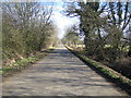
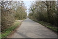
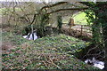
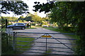
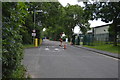
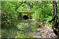
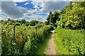
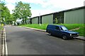
23 photos from this area
Area Information
Key information about the OX29 4LF including its size, population, and administrative classification.
- Area Type
- Postcode
- Area Size
- 62.0 hectares
- Population
- 2007
- Population Density
- 170 people/km²
House Prices in OX29 4LF
13
Properties
£739,375
Average Sold Price
£550,000
Lowest Price
£875,000
Highest Price
Showing 13 properties
| Address | Type | Beds | Baths | Last Sale Price | Last Sale Date | |
|---|---|---|---|---|---|---|
| Orchard House, 4A Cassington Road, Eynsham, OX29 4LF | house | - | - | £875,000 | Feb 2021 | |
| 2 Cassington Road, Eynsham, OX29 4LF | Land | 4 | 2 | £725,000 | Jul 2020 | |
| Honey Tree House, 2A Cassington Road, Eynsham, OX29 4LF | house | - | - | £875,000 | Feb 2020 | |
| Aragon House, 2B Cassington Road, Eynsham, OX29 4LF | house | - | - | £840,000 | Jul 2018 | |
| Holly House, 6A Cassington Road, Eynsham, OX29 4LF | house | - | - | £835,000 | Mar 2016 | |
| 8 Cassington Road, Eynsham, OX29 4LF | Detached | 5 | 3 | £565,000 | Oct 2014 | |
| Wellington House, 4B Cassington Road, Eynsham, OX29 4LF | Detached | - | - | £650,000 | Mar 2009 | |
| Gideon House, 4C Cassington Road, Eynsham, OX29 4LF | Detached | - | - | £550,000 | Mar 2009 | |
| The Flat, 10 Cassington Road, Eynsham, OX29 4LF | Flat | - | - | - | - | |
| The Flat, 4 Cassington Road, Eynsham, OX29 4LF | undefined | - | - | - | - |
Page 1 of 2
Energy Efficiency in OX29 4LF
Amenities
Schools
| Rank | School | Type | Entry gender | Ages |
|---|
Explore more schools in this area
Go to Schools tabDemographics
Household Size
Two person
most common
Accommodation Type
Houses
most common
Tenure
73
majority
Ethnic Group
White
most common
Religion
N/A
most common
Household Composition
N/A
most common
Age
47
median
Adults (30-64 years)
most common
Household Deprivation
N/A
with no deprivation
NS-SEC
49
in Lower managerial occupations
Explore more demographic insights in this area
Go to Demographics tabPlanning
Planning Constraints
- Flood RiskPremium
- Ramsar Wetland SitesPremium
- Area of Outstanding Natural BeautyPremium
- Protected Nature ReservePremium
- Protected WoodlandPremium