Area Overview for OX29 4LD
Photos of OX29 4LD
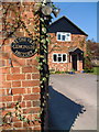
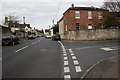
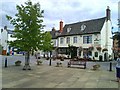
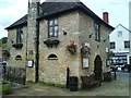

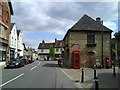
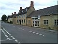
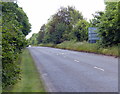
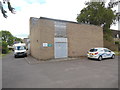
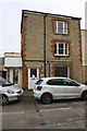
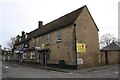
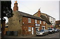
100 photos from this area
Area Information
Key information about the OX29 4LD including its size, population, and administrative classification.
- Area Type
- Postcode
- Area Size
- 1.5 hectares
- Population
- 1574
- Population Density
- 5548 people/km²
House Prices in OX29 4LD
21
Properties
£550,250
Average Sold Price
£74,000
Lowest Price
£1,005,000
Highest Price
Showing 21 properties
| Address | Type | Beds | Baths | Last Sale Price | Last Sale Date | |
|---|---|---|---|---|---|---|
| 49 Newland Street, Eynsham, OX29 4LD | Cottage | 3 | 1 | £250,000 | Apr 2024 | |
| Newland Lodge, 67 Newland Street, Eynsham, OX29 4LD | Bungalow | 3 | - | £585,000 | Mar 2019 | |
| 41 Newland Street, Eynsham, OX29 4LD | Terraced | 2 | 1 | £233,000 | Nov 2018 | |
| 59 Newland Street, Eynsham, OX29 4LD | Semi-detached | 3 | - | £440,000 | Jul 2018 | |
| 65A Newland Street, Eynsham, OX29 4LD | Bungalow | 3 | 2 | £795,000 | Dec 2017 | |
| Delves, Newland Street, Eynsham, OX29 4LD | house | - | - | £875,000 | Apr 2017 | |
| 43 Newland Street, Eynsham, OX29 4LD | Terraced | 3 | 1 | £340,000 | Feb 2017 | |
| Lane House, Newland Street, Eynsham, OX29 4LD | Detached | - | - | £800,000 | Sep 2014 | |
| The Coach House, Newland Street, Eynsham, OX29 4LD | Bungalow | 4 | 3 | £481,000 | Mar 2010 | |
| 65 Newland Street, Eynsham, OX29 4LD | Semi-detached | - | - | £725,000 | Sep 2008 |
Page 1 of 3
Energy Efficiency in OX29 4LD
Amenities
Schools
| Rank | School | Type | Entry gender | Ages |
|---|
Explore more schools in this area
Go to Schools tabDemographics
Household Size
Two person
most common
Accommodation Type
Houses
most common
Tenure
71
majority
Ethnic Group
White
most common
Religion
N/A
most common
Household Composition
N/A
most common
Age
47
median
Adults (30-64 years)
most common
Household Deprivation
N/A
with no deprivation
NS-SEC
38
in Lower managerial occupations
Explore more demographic insights in this area
Go to Demographics tabPlanning
Planning Constraints
- Flood RiskPremium
- Ramsar Wetland SitesPremium
- Area of Outstanding Natural BeautyPremium
- Protected Nature ReservePremium
- Protected WoodlandPremium