Area Overview for OX29 4AR
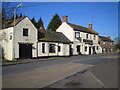
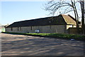
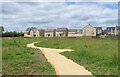
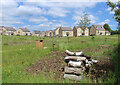
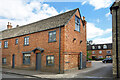
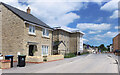
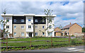
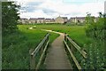
Photos of OX29 4AR


Area Information
Living in OX29 4AR offers a quiet, established experience within a specific residential cluster in England. You are part of a small community with a population of 2007 people, spread across an area with a density of 170 people per square kilometre. This low density defines a peaceful environment where neighbours are likely more neighbours' than strangers. The postcode serves as a snapshot of life in this town, combining the benefits of a tight-knit locality with reasonable access to regional roads. Daily life here revolves around a stable, residential rhythm rather than the energy of a city centre. The area functions as a sleeping community where residents return home to houses rather than high-density blocks. It is a place defined by its size and its commitment to avoiding congestion. Driving or cycling through OX29 4AR, you notice a focus on private space and established housing rather than rapid development. The area does not struggle with overcrowding, and the street layout likely supports a slow, deliberate pace typical of older English towns. You find a lifestyle that prioritises stability and familiarity. While the immediate surroundings are small, the location connects you to wider Oxfordshire networks without the noise or traffic of a major urban zone. This postcode represents a deliberate choice for those seeking a traditional setup rather than a modern, high-rise alternative. The character of the neighbourhood remains consistent because the population is large enough to sustain services but small enough to maintain a distinct village feel.
- Area Type
- Postcode
- Area Size
- Not available
- Population
- 2007
- Population Density
- 170 people/km²
The property market in OX29 4AR is dominated by the owner-occupied sector, with 73 per cent of households owning their homes. This statistic tells you that the area is not a speculative market for short-term rentals but a place for families and individuals to settle for decades.houses are the primary accommodation type, meaning you will not find high-rise blocks or larger estates within this postcode. This housing stock suggests a classic English suburban feel where gardens and private entrances are standard features. Buyers looking for a rental property in OX29 4AR may find fewer options compared to busy city centres, but those seeking a mortgage-free lifestyle will find plenty of opportunity here. The prevalence of houses across the area reflects a market that values space and permanence. When you view homes in OX29 4AR, you are buying an established asset rather than a new-build apartment. The low population density of 170 people per square kilometre further reinforces the scarcity of modern flats. This makes the location particularly attractive if you require a driveway, a garden, or specific planning that newer developments cannot offer. The market dynamics are steady because the demand comes from people wanting to put down roots. If you are looking at homes in OX29 4AR, expect a traditional transaction process and a community that welcomes settled buyers. The property stock is limited by the small population of 2007, so competition should focus on specific educational or transport connectivity needs.
House Prices in OX29 4AR
No properties found in this postcode.
Energy Efficiency in OX29 4AR
Residents of OX29 4AR enjoy practical access to five retail locations within practical reach. You can shop at Co-op Eynsham, Spar, and Tesco Eynsham for daily essentials and groceries. These venues are specific anchors that service the local community without requiring a long journey into larger urban centres. Retail convenience is a core feature of everyday life here. Beyond shopping, the area is well-connected to three railway stations: Hanborough, Combe, and Oxford Parkway. These stations provide rail links to Oxford and beyond, meaning you do not rely solely on private vehicles for longer trips. For those needing air travel, two airports are nearby, serving London Oxford Airport and Oxford Kidlington Airport. While these are smaller regional airports than Heathrow, they provide options for local flyers. The combination of rail stations and airports creates a flexible transport network. On foot, the proximity to these amenities makes OX29 4AR function as part of a wider county network. You can visit supermarkets, catch a train, or use a local airport all without significant delay. The lifestyle is defined by this efficient reach to options rather than local vibrancy. The 2007 population does not support a vast array of individually owned pubs or cafes within the postcode itself, but the named retailers ensure you have what you need.
Amenities
Schools
Families moving to OX29 4AR have access to St Peter's Church of England Primary School, located in Cassington. This institution holds a Ofsted rating of good, which provides a solid educational foundation for children in the area. The school type is primary, serving the immediate educational needs of local families before they transition to secondary education, which is not listed in the immediate vicinity. Knowing there is a good-rated school nearby reduces uncertainty for parents considering OX29 4AR. The proximity to this single named school indicates a focused catchment area, meaning you might need to consider secondary options in wider Oxfordshire. The mix of school types here is currently limited to primary education within the immediate radius. St Peter's Church of England Primary School in Cassington is a specific option you can evaluate against your children's requirements. The good rating is a concrete metric that supports the decision to move to this area. You can verify these facts through official guidance documents associated with the school. If your children attend this school, you will find them integrated into the local environment. However, the absence of listed secondary schools in the dataset means you must research further for older children. For now, living in OX29 4AR guarantees access to a primary school with a verified standard of performance.
| Rank | School | Type | Entry gender | Ages |
|---|
Explore more schools in this area
Go to Schools tabDemographics
The community in OX29 4AR is defined by a clear majority of adults living through the 30 to 64 years range. This demographic dominance shapes the area's character, moving it away from a youth-dominated scene or a retirement-heavy zone. With a median age of 47, the population reflects families in their middle years and professionals who have settled down. Home ownership is high, standing at 73 per cent, which indicates a long-term resident base rather than a transient population. You are more likely to know a neighbour's name in OX29 4AR because most people bought their homes and stayed. The accommodation type in this area consists almost entirely of houses. This contrasts with urban zones filled with apartments or flats, ensuring every household has a plot of land and a garden. This housing structure supports a family-friendly environment where outdoor space is the norm. The predominant ethnic group in OX29 4AR is White, mirroring a traditional demographic profile common in many established towns across the country. The lack of social housing prevalence, implied by the high ownership rate, suggests an affordable but competitive market where properties are valued for their permanence. Residents here are likely to have deep roots in the local history, as evidenced by the age profile and ownership statistics. When moving to OX29 4AR, you join a cohort that values stability and continuity over rapid change.
Household Size
Accommodation Type
Tenure
Ethnic Group
Religion
Household Composition
Age
Household Deprivation
NS-SEC
Explore more demographic insights in this area
Go to Demographics tabPlanning
Planning Constraints
- Flood RiskPremium
- Ramsar Wetland SitesPremium
- Area of Outstanding Natural BeautyPremium
- Protected Nature ReservePremium
- Protected WoodlandPremium