Area Overview for OX29 0SR
Photos of OX29 0SR
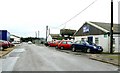
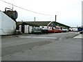
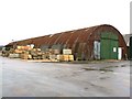
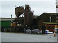
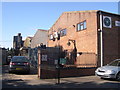
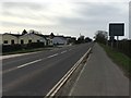
14 photos from this area
Area Information
Key information about the OX29 0SR including its size, population, and administrative classification.
- Area Type
- Postcode
- Area Size
- 6.1 hectares
- Population
- 2420
- Population Density
- 116 people/km²
House Prices in OX29 0SR
6
Properties
-
Average Sold Price
-
Lowest Price
-
Highest Price
Showing 6 properties
| Address | Type | Beds | Baths | Last Sale Price | Last Sale Date | |
|---|---|---|---|---|---|---|
| Bitcomm Business Machines Ltd, Unit 11A, Bromag Industrial Estate, Witney, OX29 0SR | Office | - | - | - | - | |
| Peter Smith & Son Funeral Directors Ltd, Unit 11F, Bromag Industrial Estate, Witney, OX29 0SR | Office | - | - | - | - | |
| C.s. Motors, Unit 30, Bromag Industrial Estate, Witney, OX29 0SR | Industrial | - | - | - | - | |
| C S Motors Ltd, Unit 31, Bromag Industrial Estate, Witney, OX29 0SR | office_workshop | - | - | - | - | |
| Chris Hayter Transport Ltd, Unit W2, Bromag Industrial Estate, Witney, OX29 0SR | storage_distribution | - | - | - | - | |
| Cotswold Fry, Mobile Catering Vehicle, Bromag Industrial Estate, Witney, OX29 0SR | Restaurant | - | - | - | - |
Energy Efficiency in OX29 0SR
Amenities
Schools
| Rank | School | Type | Entry gender | Ages |
|---|
Explore more schools in this area
Go to Schools tabDemographics
Household Size
Two person
most common
Accommodation Type
Houses
most common
Tenure
74
majority
Ethnic Group
White
most common
Religion
N/A
most common
Household Composition
N/A
most common
Age
47
median
Adults (30-64 years)
most common
Household Deprivation
N/A
with no deprivation
NS-SEC
39
in Lower managerial occupations
Explore more demographic insights in this area
Go to Demographics tabPlanning
Planning Constraints
- Flood RiskPremium
- Ramsar Wetland SitesPremium
- Area of Outstanding Natural BeautyPremium
- Protected Nature ReservePremium
- Protected WoodlandPremium