Area Overview for OX29 0SQ
Photos of OX29 0SQ
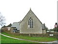
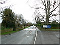
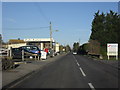

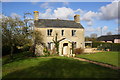
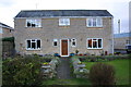
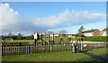
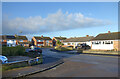

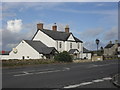
30 photos from this area
Area Information
Key information about the OX29 0SQ including its size, population, and administrative classification.
- Area Type
- Postcode
- Area Size
- 11.2 hectares
- Population
- 1436
- Population Density
- 182 people/km²
House Prices in OX29 0SQ
34
Properties
£522,769
Average Sold Price
£120,000
Lowest Price
£927,000
Highest Price
Showing 34 properties
| Address | Type | Beds | Baths | Last Sale Price | Last Sale Date | |
|---|---|---|---|---|---|---|
| 132 Brize Norton Road, Minster Lovell, OX29 0SQ | Bungalow | 4 | 1 | £755,000 | Apr 2025 | |
| 138 Brize Norton Road, Minster Lovell, OX29 0SQ | Detached | 4 | 2 | £927,000 | Sep 2022 | |
| 112 Brize Norton Road, Minster Lovell, OX29 0SQ | Bungalow | - | - | £840,000 | May 2021 | |
| 124 Brize Norton Road, Minster Lovell, OX29 0SQ | Bungalow | 4 | 1 | £525,000 | Sep 2019 | |
| Cotswold, 99 Brize Norton Road, Minster Lovell, OX29 0SQ | Bungalow | 4 | - | £480,000 | Oct 2014 | |
| 116 Brize Norton Road, Minster Lovell, OX29 0SQ | Bungalow | 5 | - | £475,000 | Jan 2014 | |
| 126 Brize Norton Road, Minster Lovell, OX29 0SQ | house | 4 | - | £590,000 | Jul 2012 | |
| 113 Brize Norton Road, Minster Lovell, OX29 0SQ | Bungalow | - | - | £325,000 | Aug 2011 | |
| Stone Gables House, 121 Brize Norton Road, Minster Lovell, OX29 0SQ | Detached | 4 | 2 | £500,000 | Jul 2008 | |
| Kingsacre, 101 Brize Norton Road, Minster Lovell, OX29 0SQ | house | - | - | £644,000 | Jun 2008 |
Page 1 of 4
Energy Efficiency in OX29 0SQ
Amenities
Schools
| Rank | School | Type | Entry gender | Ages |
|---|
Explore more schools in this area
Go to Schools tabDemographics
Household Size
Two person
most common
Accommodation Type
Houses
most common
Tenure
83
majority
Ethnic Group
White
most common
Religion
N/A
most common
Household Composition
N/A
most common
Age
47
median
Adults (30-64 years)
most common
Household Deprivation
N/A
with no deprivation
NS-SEC
34
in Lower managerial occupations
Explore more demographic insights in this area
Go to Demographics tabPlanning
Planning Constraints
- Flood RiskPremium
- Ramsar Wetland SitesPremium
- Area of Outstanding Natural BeautyPremium
- Protected Nature ReservePremium
- Protected WoodlandPremium