Area Overview for OX29 0RQ
Photos of OX29 0RQ
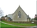
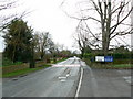

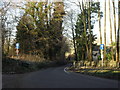
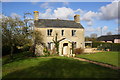
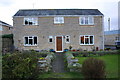
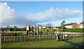
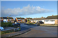

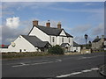
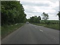
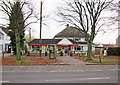
30 photos from this area
Area Information
Key information about the OX29 0RQ including its size, population, and administrative classification.
- Area Type
- Postcode
- Area Size
- 1.3 hectares
- Population
- 1436
- Population Density
- 182 people/km²
House Prices in OX29 0RQ
30
Properties
£197,764
Average Sold Price
£61,511
Lowest Price
£371,000
Highest Price
Showing 30 properties
| Address | Type | Beds | Baths | Last Sale Price | Last Sale Date | |
|---|---|---|---|---|---|---|
| 79 Wenrisc Drive, Minster Lovell, OX29 0RQ | Semi-detached | 3 | 2 | £371,000 | Sep 2025 | |
| 75 Wenrisc Drive, Minster Lovell, OX29 0RQ | Semi-detached | 3 | 1 | £340,000 | Mar 2025 | |
| 28 Wenrisc Drive, Minster Lovell, OX29 0RQ | Semi-detached | 3 | - | £274,550 | Jun 2021 | |
| 101 Wenrisc Drive, Minster Lovell, OX29 0RQ | Bungalow | 4 | - | £250,000 | Sep 2013 | |
| 40 Wenrisc Drive, Minster Lovell, OX29 0RQ | Semi-detached | 3 | - | £233,000 | Jul 2013 | |
| 26 Wenrisc Drive, Minster Lovell, OX29 0RQ | Detached | 3 | 1 | £177,500 | May 2011 | |
| 89 Wenrisc Drive, Minster Lovell, OX29 0RQ | Detached | 5 | - | £235,000 | Oct 2010 | |
| 34 Wenrisc Drive, Minster Lovell, OX29 0RQ | house | - | - | £205,000 | Oct 2010 | |
| 93 Wenrisc Drive, Minster Lovell, OX29 0RQ | Semi-detached | - | - | £250,000 | Feb 2009 | |
| 81 Wenrisc Drive, Minster Lovell, OX29 0RQ | Bungalow | - | - | £220,000 | Nov 2008 |
Page 1 of 3
Energy Efficiency in OX29 0RQ
Amenities
Schools
| Rank | School | Type | Entry gender | Ages |
|---|
Explore more schools in this area
Go to Schools tabDemographics
Household Size
Two person
most common
Accommodation Type
Houses
most common
Tenure
83
majority
Ethnic Group
White
most common
Religion
N/A
most common
Household Composition
N/A
most common
Age
47
median
Adults (30-64 years)
most common
Household Deprivation
N/A
with no deprivation
NS-SEC
34
in Lower managerial occupations
Explore more demographic insights in this area
Go to Demographics tabPlanning
Planning Constraints
- Flood RiskPremium
- Ramsar Wetland SitesPremium
- Area of Outstanding Natural BeautyPremium
- Protected Nature ReservePremium
- Protected WoodlandPremium