Area Overview for OX29 0AE
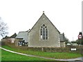
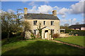
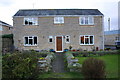
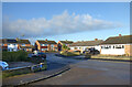
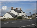
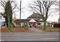
Photos of OX29 0AE


Area Information
Ox29 0AE occupies a small, defined residential cluster covering just 1.1 hectares within England. This compact footprint supports a population of 1,436 people, resulting in a population density of 182 people per square kilometre. Living in OX29 0AE means residing in a contained community where neighbours are often within close proximity. The area operates as a dense pocket of housing rather than a sprawling neighbourhood. This concentration creates an environment where daily routines are tightly bound to local infrastructure. Residents experience a sense of intimacy that larger towns often lack. The specific postcode designation identifies this precise location for potential buyers seeking a discrete living arrangement. You can expect a setting that prioritises direct access to essentials over expansive green spaces. The sheer size of the area dictates the pace of daily life, favouring short walks and immediate availability of services. This cluster-like structure defines the character of homes in OX29 0AE.
- Area Type
- Postcode
- Area Size
- 1.1 hectares
- Population
- 1436
- Population Density
- 182 people/km²
The property market in OX29 0AE is characterised by a strong focus on owner-occupied housing. An impressive 83% of residents own their homes, creating a market dominated by those with a vested interest in property values. This high ownership rate contrasts sharply with rental-dominated districts. The entire area comprises houses as the primary accommodation type. You will not encounter flats or apartments within the OX29 0AE boundary. This uniformity in building style moulds the visual character of the neighbourhood and influences noise levels and deprivation patterns. The small area size of 1.1 hectares further constrains the available housing stock, making each listing significant. Buyers looking at homes in OX29 0AE are entering a space defined by permanence and legislative boundaries suited to detached or semi-detached structures. The lack of rental housing implies limited short-term options for transient professionals. Instead, the market serves established households seeking security and continuity. The specific nature of the housing stock means properties are built to last, with fewer shared walls or communal maintenance issues found in apartment blocks.
House Prices in OX29 0AE
Showing 6 properties
| Address | Type | Beds | Baths | Last Sale Price | Last Sale Date | |
|---|---|---|---|---|---|---|
| 4, The Limes, Brize Norton Road, Minster Lovell, OX29 0AE | Bungalow | 3 | 2 | - | - | |
| 5, The Limes, Brize Norton Road, Minster Lovell, OX29 0AE | Bungalow | - | - | - | - | |
| 1, The Limes, Brize Norton Road, Minster Lovell, OX29 0AE | Bungalow | - | - | - | - | |
| 6, The Limes, Brize Norton Road, Minster Lovell, OX29 0AE | Bungalow | - | - | - | - | |
| 2, The Limes, Brize Norton Road, Minster Lovell, OX29 0AE | Bungalow | - | - | - | - | |
| 3, The Limes, Brize Norton Road, Minster Lovell, OX29 0AE | Bungalow | - | - | - | - |
Energy Efficiency in OX29 0AE
Residents of OX29 0AE benefit from practical access to retail and transport hubs within a short practical reach. There are five notable nearby amenities including Spar, Tesco Witney, and another Tesco Witney location. These retail venues provide comprehensive grocery shopping and daily necessities without requiring long drives. For air travel, RAF Brize Norton stands as the nearest airport facility. Public rail travel is facilitated by four nearby stations including Ascott, Finstock Railway Station, and Shipton Railway Station. Access to these four rail nodes offers commuting flexibility for those working in larger towns like Oxford or Banbury. The presence of multiple Tesco locations ensures household shopping is both convenient and competitive. You can conduct most errands locally before catching a train or driving to the airport if required. This mix of retail and transport nodes defines the lifestyle convenience available to homeowners. The area supports a hybrid lifestyle balancing local shopping with broader regional connectivity. Living in OX29 0AE grants immediate access to these five retail points and four railway stations.
Amenities
Schools
Families living in OX29 0AE have access to St Kenelm's Church of England (VC) School, which is located immediately near the area. This institution operates as a primary school and holds a Ofsted rating of good. The presence of a single named school in the data suggests a reliance on this specific provider for primary education within the immediate vicinity. There are no secondary schools explicitly listed for this postcode in the provided information. The Ofsted rating of good indicates that the school meets expected standards for educational quality and safety. A primary school alone implies that older children must travel outside the immediate neighbourhood for secondary education. The school type being Church of England may reflect the historical character of the surrounding community. Parents considering schools near OX29 0AE will find this one specific option highlighted for the primary stage. The limited school data focuses attention solely on this established primary institution serving the local cluster.
| Rank | School | Type | Entry gender | Ages |
|---|
Explore more schools in this area
Go to Schools tabDemographics
The community within OX29 0AE is defined by a stable demographic profile centred on adults aged 30 to 64 years. The median age stands at 47, indicating a population skewed significantly towards middle-aged residents. This age group represents the most common demographic range in the area. Residents here are generally settled, reflected in a home ownership rate of 83%. Such a high percentage suggests that most families and individuals have established roots rather than maintaining transient tenancies. The accommodation type is exclusively houses, meaning you will not find apartments or flats within this specific postcode. Predominantly, the ethnic group is White, contributing to a culturally consistent neighbourhood environment. There are no significant pockets of ethnic diversity within the recorded statistics for this zone. The age profile and ownership data suggest a quiet, long-term residency model. People living in OX29 0AE are likely familiar with their surroundings and invested in the long-term stability of the homes they occupy. This demographic makeup supports a mature community atmosphere without substantial youth or elderly concentrations.
Household Size
Accommodation Type
Tenure
Ethnic Group
Religion
Household Composition
Age
Household Deprivation
NS-SEC
Explore more demographic insights in this area
Go to Demographics tabPlanning
Planning Constraints
- Flood RiskPremium
- Ramsar Wetland SitesPremium
- Area of Outstanding Natural BeautyPremium
- Protected Nature ReservePremium
- Protected WoodlandPremium