Area Overview for OX28 6LP
Photos of OX28 6LP
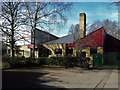
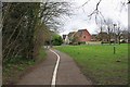
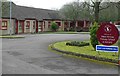
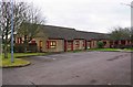
40 photos from this area
Area Information
Key information about the OX28 6LP including its size, population, and administrative classification.
- Area Type
- Postcode
- Area Size
- 1.2 hectares
- Population
- 2327
- Population Density
- 2829 people/km²
House Prices in OX28 6LP
24
Properties
£300,091
Average Sold Price
£167,000
Lowest Price
£585,000
Highest Price
Showing 24 properties
| Address | Type | Beds | Baths | Last Sale Price | Last Sale Date | |
|---|---|---|---|---|---|---|
| 31 Beech Road, Witney, OX28 6LP | Bungalow | 2 | 1 | £305,000 | Sep 2024 | |
| 35 Beech Road, Witney, OX28 6LP | Semi-detached | 3 | 2 | £400,000 | Jul 2024 | |
| 47 Beech Road, Witney, OX28 6LP | Detached | 2 | 2 | £585,000 | Jan 2023 | |
| 33 Beech Road, Witney, OX28 6LP | Bungalow | - | - | £405,000 | Aug 2022 | |
| 37 Beech Road, Witney, OX28 6LP | Terraced | 4 | 1 | £365,000 | May 2021 | |
| 21 Beech Road, Witney, OX28 6LP | Bungalow | 2 | 1 | £270,000 | Sep 2020 | |
| 45 Beech Road, Witney, OX28 6LP | Semi-detached | 3 | 1 | £300,000 | Apr 2020 | |
| 3 Beech Road, Witney, OX28 6LP | Bungalow | 2 | - | £295,000 | Apr 2019 | |
| 1 Beech Road, Witney, OX28 6LP | Bungalow | 3 | 1 | £275,000 | Dec 2015 | |
| 41 Beech Road, Witney, OX28 6LP | Semi-detached | 3 | - | £280,000 | Mar 2014 |
Page 1 of 3
Energy Efficiency in OX28 6LP
Amenities
Schools
| Rank | School | Type | Entry gender | Ages |
|---|
Explore more schools in this area
Go to Schools tabDemographics
Household Size
Two person
most common
Accommodation Type
Houses
most common
Tenure
66
majority
Ethnic Group
White
most common
Religion
N/A
most common
Household Composition
N/A
most common
Age
47
median
Adults (30-64 years)
most common
Household Deprivation
N/A
with no deprivation
NS-SEC
35
in Lower managerial occupations
Explore more demographic insights in this area
Go to Demographics tabPlanning
Planning Constraints
- Flood RiskPremium
- Ramsar Wetland SitesPremium
- Area of Outstanding Natural BeautyPremium
- Protected Nature ReservePremium
- Protected WoodlandPremium