Area Overview for OX28 6EY
Photos of OX28 6EY

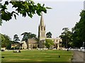
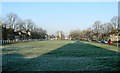
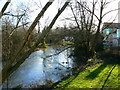
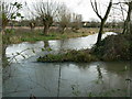
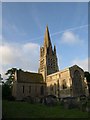

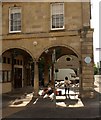
100 photos from this area
Area Information
Key information about the OX28 6EY including its size, population, and administrative classification.
- Area Type
- Postcode
- Area Size
- 1.5 hectares
- Population
- 1653
- Population Density
- 1742 people/km²
House Prices in OX28 6EY
54
Properties
£236,194
Average Sold Price
£76,000
Lowest Price
£481,000
Highest Price
Showing 54 properties
| Address | Type | Beds | Baths | Last Sale Price | Last Sale Date | |
|---|---|---|---|---|---|---|
| 22 Langdale Gate, Witney, OX28 6EY | Flat | - | - | £200,000 | Aug 2025 | |
| 92 Langdale Gate, Witney, OX28 6EY | Semi-detached | 4 | 2 | £425,000 | Mar 2025 | |
| 66 Langdale Gate, Witney, OX28 6EY | Flat | 1 | 1 | £211,187 | Apr 2024 | |
| 62 Langdale Gate, Witney, OX28 6EY | Flat | 1 | 1 | £204,000 | Sep 2023 | |
| 50 Langdale Gate, Witney, OX28 6EY | Semi-detached | 3 | 2 | £481,000 | Jul 2023 | |
| 112 Langdale Gate, Witney, OX28 6EY | house | 2 | 1 | £340,000 | Aug 2022 | |
| 108 Langdale Gate, Witney, OX28 6EY | Flat | 1 | 1 | £188,000 | Jun 2022 | |
| 72 Langdale Gate, Witney, OX28 6EY | Semi-detached | 3 | - | £380,000 | May 2022 | |
| 84 Langdale Gate, Witney, OX28 6EY | house | - | - | £275,000 | May 2021 | |
| 38 Langdale Gate, Witney, OX28 6EY | house | - | - | £375,000 | Jan 2021 |
Page 1 of 6
Energy Efficiency in OX28 6EY
Amenities
Schools
| Rank | School | Type | Entry gender | Ages |
|---|
Explore more schools in this area
Go to Schools tabDemographics
Household Size
One person
most common
Accommodation Type
Houses
most common
Tenure
63
majority
Ethnic Group
White
most common
Religion
N/A
most common
Household Composition
N/A
most common
Age
47
median
Adults (30-64 years)
most common
Household Deprivation
N/A
with no deprivation
NS-SEC
40
in Lower managerial occupations
Explore more demographic insights in this area
Go to Demographics tabPlanning
Planning Constraints
- Flood RiskPremium
- Ramsar Wetland SitesPremium
- Area of Outstanding Natural BeautyPremium
- Protected Nature ReservePremium
- Protected WoodlandPremium