Area Overview for OX28 6EG
Photos of OX28 6EG

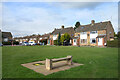
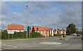
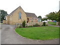
21 photos from this area
Area Information
Key information about the OX28 6EG including its size, population, and administrative classification.
- Area Type
- Postcode
- Area Size
- 1.3 hectares
- Population
- 2327
- Population Density
- 2829 people/km²
House Prices in OX28 6EG
27
Properties
£250,127
Average Sold Price
£41,895
Lowest Price
£375,000
Highest Price
Showing 27 properties
| Address | Type | Beds | Baths | Last Sale Price | Last Sale Date | |
|---|---|---|---|---|---|---|
| 22 Springfield Oval, Witney, OX28 6EG | Retail | 3 | - | £350,000 | Jul 2022 | |
| 12 Springfield Oval, Witney, OX28 6EG | Semi-detached | 3 | 1 | £300,000 | Feb 2019 | |
| 5 Springfield Oval, Witney, OX28 6EG | Semi-detached | 4 | 1 | £375,000 | Aug 2018 | |
| 6 Springfield Oval, Witney, OX28 6EG | Semi-detached | 4 | 1 | £362,000 | Jul 2018 | |
| 26 Springfield Oval, Witney, OX28 6EG | Semi-detached | 4 | 2 | £260,000 | Jan 2015 | |
| 25 Springfield Oval, Witney, OX28 6EG | Semi-detached | 3 | - | £287,000 | Oct 2014 | |
| 2 Springfield Oval, Witney, OX28 6EG | Semi-detached | 4 | 2 | £250,000 | Jul 2013 | |
| 18 Springfield Oval, Witney, OX28 6EG | Semi-detached | - | - | £220,000 | Aug 2008 | |
| 16 Springfield Oval, Witney, OX28 6EG | Semi-detached | - | - | £197,500 | Apr 2005 | |
| 20 Springfield Oval, Witney, OX28 6EG | Semi-detached | 3 | - | £108,000 | Jul 2001 |
Page 1 of 3
Energy Efficiency in OX28 6EG
Amenities
Schools
| Rank | School | Type | Entry gender | Ages |
|---|
Explore more schools in this area
Go to Schools tabDemographics
Household Size
Two person
most common
Accommodation Type
Houses
most common
Tenure
66
majority
Ethnic Group
White
most common
Religion
N/A
most common
Household Composition
N/A
most common
Age
47
median
Adults (30-64 years)
most common
Household Deprivation
N/A
with no deprivation
NS-SEC
35
in Lower managerial occupations
Explore more demographic insights in this area
Go to Demographics tabPlanning
Planning Constraints
- Flood RiskPremium
- Ramsar Wetland SitesPremium
- Area of Outstanding Natural BeautyPremium
- Protected Nature ReservePremium
- Protected WoodlandPremium