Area Overview for OX28 6ED
Photos of OX28 6ED
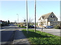
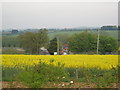
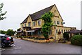
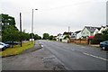
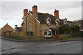

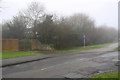
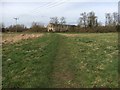
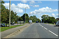
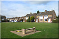
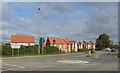
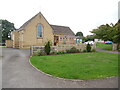
21 photos from this area
Area Information
Key information about the OX28 6ED including its size, population, and administrative classification.
- Area Type
- Postcode
- Area Size
- 1.8 hectares
- Population
- 2327
- Population Density
- 2829 people/km²
House Prices in OX28 6ED
16
Properties
£791,550
Average Sold Price
£189,500
Lowest Price
£1,220,000
Highest Price
Showing 16 properties
| Address | Type | Beds | Baths | Last Sale Price | Last Sale Date | |
|---|---|---|---|---|---|---|
| 101 Burford Road, Witney, OX28 6ED | Detached | 6 | 3 | £980,000 | Nov 2024 | |
| Mistletoe House, 107A Burford Road, Witney, OX28 6ED | Detached | 5 | 3 | £1,191,000 | Sep 2024 | |
| 105 Burford Road, Witney, OX28 6ED | Detached | 4 | 2 | £890,000 | Jun 2023 | |
| 109A Burford Road, Witney, OX28 6ED | Retail | 6 | 5 | £1,220,000 | Nov 2022 | |
| 121 Burford Road, Witney, OX28 6ED | house | - | - | £725,000 | Feb 2022 | |
| 119 Burford Road, Witney, OX28 6ED | house | - | - | £370,000 | May 2020 | |
| Stonecroft, 109 Burford Road, Witney, OX28 6ED | Detached | 5 | 3 | £840,000 | Sep 2019 | |
| 115 Burford Road, Witney, OX28 6ED | Semi-detached | 5 | 3 | £590,000 | Nov 2017 | |
| North View House, 111 Burford Road, Witney, OX28 6ED | Detached | 5 | - | £920,000 | Aug 2017 | |
| 113 Burford Road, Witney, OX28 6ED | house | - | - | £189,500 | Jan 2002 |
Page 1 of 2
Energy Efficiency in OX28 6ED
Amenities
Schools
| Rank | School | Type | Entry gender | Ages |
|---|
Explore more schools in this area
Go to Schools tabDemographics
Household Size
Two person
most common
Accommodation Type
Houses
most common
Tenure
66
majority
Ethnic Group
White
most common
Religion
N/A
most common
Household Composition
N/A
most common
Age
47
median
Adults (30-64 years)
most common
Household Deprivation
N/A
with no deprivation
NS-SEC
35
in Lower managerial occupations
Explore more demographic insights in this area
Go to Demographics tabPlanning
Planning Constraints
- Flood RiskPremium
- Ramsar Wetland SitesPremium
- Area of Outstanding Natural BeautyPremium
- Protected Nature ReservePremium
- Protected WoodlandPremium