Area Overview for OX28 5NJ
Photos of OX28 5NJ
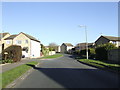
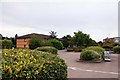

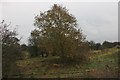
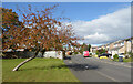
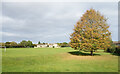
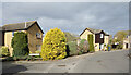
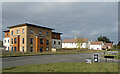
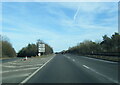
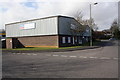

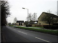
15 photos from this area
Area Information
Key information about the OX28 5NJ including its size, population, and administrative classification.
- Area Type
- Postcode
- Area Size
- 8280 m²
- Population
- 1288
- Population Density
- 5303 people/km²
House Prices in OX28 5NJ
34
Properties
£227,152
Average Sold Price
£63,950
Lowest Price
£327,500
Highest Price
Showing 34 properties
| Address | Type | Beds | Baths | Last Sale Price | Last Sale Date | |
|---|---|---|---|---|---|---|
| 43 Colwell Drive, Witney, OX28 5NJ | Semi-detached | 3 | 1 | £327,500 | Sep 2025 | |
| 49A Colwell Drive, Witney, OX28 5NJ | Terraced | 2 | 1 | £275,000 | May 2025 | |
| 19 Colwell Drive, Witney, OX28 5NJ | Terraced | 3 | 1 | £300,000 | Jun 2024 | |
| 47A Colwell Drive, Witney, OX28 5NJ | Terraced | 2 | 1 | £245,000 | Apr 2021 | |
| 59 Colwell Drive, Witney, OX28 5NJ | Semi-detached | 3 | 1 | £290,000 | Jan 2021 | |
| 25 Colwell Drive, Witney, OX28 5NJ | Terraced | 3 | 1 | £241,000 | Mar 2019 | |
| 27 Colwell Drive, Witney, OX28 5NJ | Terraced | 3 | 1 | £272,000 | Jun 2018 | |
| 1B Colwell Drive, Witney, OX28 5NJ | Semi-detached | 2 | - | £267,000 | Jun 2018 | |
| 41 Colwell Drive, Witney, OX28 5NJ | Semi-detached | 3 | - | £248,000 | May 2018 | |
| 21 Colwell Drive, Witney, OX28 5NJ | Terraced | 3 | 1 | £240,000 | Nov 2016 |
Page 1 of 4
Energy Efficiency in OX28 5NJ
Amenities
Schools
| Rank | School | Type | Entry gender | Ages |
|---|
Explore more schools in this area
Go to Schools tabDemographics
Household Size
Family (3-5 people)
most common
Accommodation Type
Houses
most common
Tenure
75
majority
Ethnic Group
White
most common
Religion
N/A
most common
Household Composition
N/A
most common
Age
47
median
Adults (30-64 years)
most common
Household Deprivation
N/A
with no deprivation
NS-SEC
28
in Lower managerial occupations
Explore more demographic insights in this area
Go to Demographics tabPlanning
Planning Constraints
- Flood RiskPremium
- Ramsar Wetland SitesPremium
- Area of Outstanding Natural BeautyPremium
- Protected Nature ReservePremium
- Protected WoodlandPremium