Area Overview for OX28 5LF
Photos of OX28 5LF

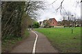

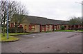
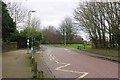
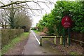

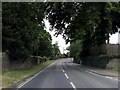
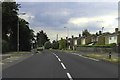

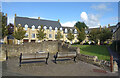
40 photos from this area
Area Information
Key information about the OX28 5LF including its size, population, and administrative classification.
- Area Type
- Postcode
- Area Size
- 3970 m²
- Population
- 1288
- Population Density
- 5303 people/km²
House Prices in OX28 5LF
17
Properties
£235,188
Average Sold Price
£135,000
Lowest Price
£335,000
Highest Price
Showing 17 properties
| Address | Type | Beds | Baths | Last Sale Price | Last Sale Date | |
|---|---|---|---|---|---|---|
| 68 Abbey Road, Witney, OX28 5LF | Semi-detached | 3 | 1 | £335,000 | Jul 2024 | |
| 62 Abbey Road, Witney, OX28 5LF | Semi-detached | 4 | 2 | £310,000 | Sep 2016 | |
| 58 Abbey Road, Witney, OX28 5LF | house | - | - | £260,000 | Jul 2016 | |
| 70 Abbey Road, Witney, OX28 5LF | Semi-detached | 3 | 1 | £257,500 | Jun 2015 | |
| 74 Abbey Road, Witney, OX28 5LF | house | - | - | £203,000 | Sep 2010 | |
| 84 Abbey Road, Witney, OX28 5LF | house | - | - | £211,000 | Nov 2009 | |
| 76 Abbey Road, Witney, OX28 5LF | Semi-detached | - | - | £170,000 | Nov 2005 | |
| 56 Abbey Road, Witney, OX28 5LF | house | 3 | - | £135,000 | Aug 2001 | |
| 54 Abbey Road, Witney, OX28 5LF | Semi-detached | 3 | - | - | - | |
| 86 Abbey Road, Witney, OX28 5LF | house | - | - | - | - |
Page 1 of 2
Energy Efficiency in OX28 5LF
Amenities
Schools
| Rank | School | Type | Entry gender | Ages |
|---|
Explore more schools in this area
Go to Schools tabDemographics
Household Size
Family (3-5 people)
most common
Accommodation Type
Houses
most common
Tenure
75
majority
Ethnic Group
White
most common
Religion
N/A
most common
Household Composition
N/A
most common
Age
47
median
Adults (30-64 years)
most common
Household Deprivation
N/A
with no deprivation
NS-SEC
28
in Lower managerial occupations
Explore more demographic insights in this area
Go to Demographics tabPlanning
Planning Constraints
- Flood RiskPremium
- Ramsar Wetland SitesPremium
- Area of Outstanding Natural BeautyPremium
- Protected Nature ReservePremium
- Protected WoodlandPremium