Area Overview for OX28 5JP
Photos of OX28 5JP


Area Information
OX28 5JP represents a compact residential cluster with a precise footprint of 5699 square metres. This postcode serves exactly 1288 residents, creating a neighbourhood defined by its intimate scale rather than broad sprawl. You will find that the density here reaches 225,995 people per square kilometre, which indicates a concentrated settlement where services and neighbours are naturally close at hand. Living in this specific area means residing within a tightly defined community boundary where daily interactions with the surrounding environment are immediate. The physical limits of the postcode area enforce a sense of locality, ensuring that residents do not experience the anonymity often found in larger urban districts. Your day-to-day life spans a short distance, as the entire population is contained within a space that feels distinct and manageable. This concentration shapes a living experience where the boundaries of your immediate region are clearly understood. Prospective buyers seeking a defined area with a clear sense of place will find OX28 5JP to be a contained and stable residential zone. The small total area ensures that the character of the locale remains authentic and accessible to all dwelling within these limits.
- Area Type
- Postcode
- Area Size
- 5699 m²
- Population
- 1288
- Population Density
- 5303 people/km²
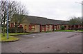
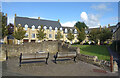
Housing in OX28 5JP is characterised by a dominance of houses rather than other forms of residential accommodation. This structural reality aligns with the high home ownership rate of 75 per cent, which classifies the market as predominantly owner-occupied. You are unlikely to find a large proportion of private rental properties, as the stock caters to residents who have established themselves in the area. The accommodation type focuses on standalone or semi-detached dwellings, fitting the profile of a standard English suburban or semi-rural residential zone. This market composition means that if you are looking to purchase, you are entering an environment where owners have deep ties to their specific addresses. Investors seeking high yield from frequent turnovers may find this smaller cluster less dynamic, as the turnover is likely lower due to the large ownership base. The property types are consistent with the demographic, favouring family-sized homes or retirement properties over student lets or shared houses. Buying here offers the security of a stable neighbourhood where property values are often supported by the long-term commitment of occupants. The homogeneity of the housing stock also simplifies the search for buyers who have specific requirements regarding garden space or building style typical of this region.
House Prices in OX28 5JP
Showing 16 properties
| Address | Type | Beds | Baths | Last Sale Price | Last Sale Date | |
|---|---|---|---|---|---|---|
| Quarters House, 1A French Close, Witney, OX28 5JP | Terraced | 3 | 1 | £345,000 | Mar 2025 | |
| 1 French Close, Witney, OX28 5JP | Terraced | 3 | 1 | £373,000 | Nov 2024 | |
| 10 French Close, Witney, OX28 5JP | Semi-detached | 3 | 1 | £275,000 | Aug 2021 | |
| 4 French Close, Witney, OX28 5JP | Semi-detached | 3 | 2 | £290,000 | Nov 2017 | |
| 18 French Close, Witney, OX28 5JP | Semi-detached | 3 | 2 | £295,000 | Nov 2017 | |
| 14 French Close, Witney, OX28 5JP | Semi-detached | 4 | 1 | £310,000 | Dec 2016 | |
| 5 French Close, Witney, OX28 5JP | Semi-detached | 3 | - | £240,000 | Dec 2013 | |
| 2 French Close, Witney, OX28 5JP | house | - | - | £245,000 | May 2011 | |
| 3 French Close, Witney, OX28 5JP | Semi-detached | - | - | £197,500 | Jul 2006 | |
| 20 French Close, Witney, OX28 5JP | Semi-detached | - | - | £82,500 | Jan 1998 |
Energy Efficiency in OX28 5JP
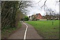
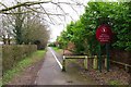
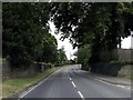
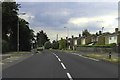
Daily life in OX28 5JP revolves around proximity to essential services and retail hubs. There are five notable amenities in the retail sector, specifically including Spar, Tesco Witney, and Tesco Witney Station. These venues mean that shopping for groceries, household items, or fuel is a short journey away for any resident. You do not need to travel far into town to access these facilities, which are located within practical reach of every home in the postcode. Leisure options include leisure time spent near amenities such as the commercial units at the railway stations. Transport links further enhance lifestyle convenience through the presence of Finstock Railway Station, Combe Railway Station, and Hanborough Railway Station. The area also sits near RAF Brize Norton, which while an airport, adds to the surrounding infrastructure density. This concentration of amenities creates a neighbourhood where errands are efficient and local commerce is active. You will find that the variety of shops supports both everyday needs and occasional larger purchases. The presence of multiple Tesco locations suggests a well-served area where competition might keep prices reasonable. Living here offers a balance of convenience and quietness, as you have major retailers close by but remain in a residential cluster defined by its 1288 residents.
Amenities
Schools
Families considering OX28 5JP for property sales can look to Queen Emma's Primary School for their children's education. This institution is a primary school situated conveniently near the postcode and currently holds an Ofsted rating of good. The school offers secondary education for younger children but no data is provided for secondary options, so you should verify future schooling needs independently. The presence of this single named primary institution indicates that very young children are catered for within immediate proximity to living in this area. While the data does not list secondary schools, the existence of a local primary school with a positive rating is a practical reassurance for early-stage education. Children attending Queen Emma's Primary School benefit from a rating that suggests a quality standard recognised by officials. You should note that beyond this one specific school, there is no further granular data on the availability of other educational facilities nearby. This means parents must look beyond the immediate postcode for older students if the local secondary options do not meet their criteria. The current evidence supports the area as suitable for early schooling, but further research is necessary for comprehensive family planning across all school ages.
| Rank | School | Type | Entry gender | Ages |
|---|
Explore more schools in this area
Go to Schools tabDemographics
The community profile of OX28 5JP reflects a mature and established population structure. Seventy-five per cent of households within this area own their homes, demonstrating a strong preference for stability and long-term roots. Residents primarily occupy houses, meaning the accommodation type aligns with traditional family living or single-home ownership rather than high-density flats. The median age for inhabitants stands at 47 years, and the most common age range consists of adults between 30 and 64 years. This demographic skew suggests a population composed largely of working families or those approaching retirement, rather than young professionals or retirees. White residents form the predominant ethnic group, contributing to a homogenous social fabric that has developed over time. You can expect a neighbourhood where neighbours are likely to be peers in age and lifestyle. Practical aspects of deprivation are not highlighted in the data, but the high home ownership rate suggests financial security among the majority. The absence of young adult clusters points away from a transient student population or a bustling youth hub. Instead, the area functions as a settled residence for those further along in their adult lives, valuing quiet stability over urban vibrancy.
Household Size
Accommodation Type
Tenure
Ethnic Group
Religion
Household Composition
Age
Household Deprivation
NS-SEC
Explore more demographic insights in this area
Go to Demographics tabPlanning
Planning Constraints
- Flood RiskPremium
- Ramsar Wetland SitesPremium
- Area of Outstanding Natural BeautyPremium
- Protected Nature ReservePremium
- Protected WoodlandPremium