Area Overview for OX28 3JZ
Photos of OX28 3JZ
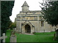
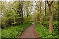
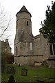
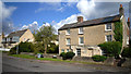
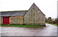
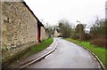
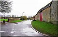
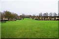
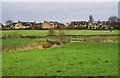
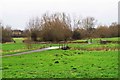
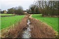
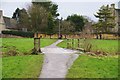
84 photos from this area
Area Information
Key information about the OX28 3JZ including its size, population, and administrative classification.
- Area Type
- Postcode
- Area Size
- 1.0 hectares
- Population
- 1359
- Population Density
- 3739 people/km²
House Prices in OX28 3JZ
15
Properties
£278,592
Average Sold Price
£138,000
Lowest Price
£410,000
Highest Price
Showing 15 properties
| Address | Type | Beds | Baths | Last Sale Price | Last Sale Date | |
|---|---|---|---|---|---|---|
| 18 Church Lane, Witney, OX28 3JZ | Terraced | 4 | 2 | £410,000 | Dec 2023 | |
| 22 Church Lane, Witney, OX28 3JZ | Terraced | 2 | 1 | £380,000 | Oct 2022 | |
| 8 Church Lane, Witney, OX28 3JZ | house | 4 | - | £366,500 | Mar 2021 | |
| 4 Church Lane, Witney, OX28 3JZ | Terraced | 3 | - | £265,000 | Sep 2020 | |
| 24 Church Lane, Witney, OX28 3JZ | Terraced | 2 | 1 | £335,000 | Oct 2018 | |
| 20 Church Lane, Witney, OX28 3JZ | Terraced | 2 | 1 | £320,000 | Aug 2018 | |
| 10 Church Lane, Witney, OX28 3JZ | house | 2 | - | £315,000 | Jul 2016 | |
| 14 Church Lane, Witney, OX28 3JZ | Terraced | 3 | - | £278,000 | Oct 2015 | |
| 6 Church Lane, Witney, OX28 3JZ | Terraced | - | - | £237,500 | Jul 2006 | |
| 16 Church Lane, Witney, OX28 3JZ | Terraced | - | - | £157,000 | Jul 2002 |
Page 1 of 2
Energy Efficiency in OX28 3JZ
Amenities
Schools
| Rank | School | Type | Entry gender | Ages |
|---|
Explore more schools in this area
Go to Schools tabDemographics
Household Size
Two person
most common
Accommodation Type
Houses
most common
Tenure
75
majority
Ethnic Group
White
most common
Religion
N/A
most common
Household Composition
N/A
most common
Age
47
median
Adults (30-64 years)
most common
Household Deprivation
N/A
with no deprivation
NS-SEC
48
in Lower managerial occupations
Explore more demographic insights in this area
Go to Demographics tabPlanning
Planning Constraints
- Flood RiskPremium
- Ramsar Wetland SitesPremium
- Area of Outstanding Natural BeautyPremium
- Protected Nature ReservePremium
- Protected WoodlandPremium