Area Overview for OX27 7NS
Photos of OX27 7NS
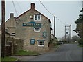

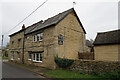
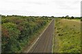
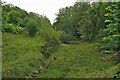

13 photos from this area
Area Information
Key information about the OX27 7NS including its size, population, and administrative classification.
- Area Type
- Postcode
- Area Size
- 10.9 hectares
- Population
- 2488
- Population Density
- 73 people/km²
House Prices in OX27 7NS
10
Properties
£364,850
Average Sold Price
£89,950
Lowest Price
£855,000
Highest Price
Showing 10 properties
| Address | Type | Beds | Baths | Last Sale Price | Last Sale Date | |
|---|---|---|---|---|---|---|
| Meadowbank, Somerton Road, Ardley, OX27 7NS | Detached | 6 | 4 | £412,000 | Nov 2015 | |
| Derwent Cottage, Somerton Road, Ardley, OX27 7NS | Detached | 3 | 1 | £380,000 | Feb 2014 | |
| Old Wheelwrights, Somerton Road, Ardley, OX27 7NS | Detached | 4 | - | £855,000 | Aug 2007 | |
| Hunters Cottage, Somerton Road, Ardley, OX27 7NS | Detached | 3 | 1 | £325,000 | Jul 2006 | |
| Manor Barn, Somerton Road, Ardley, OX27 7NS | Detached | - | - | £340,000 | Oct 2002 | |
| 71 Somerton Road, Ardley, OX27 7NS | Detached | - | - | £152,000 | Jul 2001 | |
| Leycroft, Somerton Road, Ardley, OX27 7NS | house | 4 | - | £89,950 | Mar 1995 | |
| Ardley House, Somerton Road, Ardley, OX27 7NS | house | 8 | - | - | - | |
| Manor Farm, Somerton Road, Ardley, OX27 7NS | Detached | - | - | - | - | |
| The Beeches, Somerton Road, Ardley, OX27 7NS | Detached | - | - | - | - |
Energy Efficiency in OX27 7NS
Amenities
Schools
| Rank | School | Type | Entry gender | Ages |
|---|
Explore more schools in this area
Go to Schools tabDemographics
Household Size
Two person
most common
Accommodation Type
Houses
most common
Tenure
70
majority
Ethnic Group
White
most common
Religion
N/A
most common
Household Composition
N/A
most common
Age
47
median
Adults (30-64 years)
most common
Household Deprivation
N/A
with no deprivation
NS-SEC
46
in Lower managerial occupations
Explore more demographic insights in this area
Go to Demographics tabPlanning
Planning Constraints
- Flood RiskPremium
- Ramsar Wetland SitesPremium
- Area of Outstanding Natural BeautyPremium
- Protected Nature ReservePremium
- Protected WoodlandPremium