Area Overview for OX26 6WF
Photos of OX26 6WF
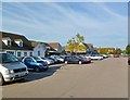
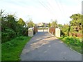
100 photos from this area
Area Information
Key information about the OX26 6WF including its size, population, and administrative classification.
- Area Type
- Postcode
- Area Size
- 2.0 hectares
- Population
- 2592
- Population Density
- 4493 people/km²
House Prices in OX26 6WF
25
Properties
£239,276
Average Sold Price
£115,950
Lowest Price
£400,000
Highest Price
Showing 25 properties
| Address | Type | Beds | Baths | Last Sale Price | Last Sale Date | |
|---|---|---|---|---|---|---|
| 8 Sanderling Close, Bicester, OX26 6WF | Semi-detached | 3 | 1 | £400,000 | Oct 2025 | |
| 1 Sanderling Close, Bicester, OX26 6WF | Terraced | 3 | 2 | £380,000 | Apr 2024 | |
| 3 Sanderling Close, Bicester, OX26 6WF | Semi-detached | 3 | 3 | £375,000 | Feb 2024 | |
| 5 Sanderling Close, Bicester, OX26 6WF | house | 3 | - | £320,000 | Jun 2021 | |
| 20 Sanderling Close, Bicester, OX26 6WF | house | 2 | 1 | £257,500 | Mar 2021 | |
| 16 Sanderling Close, Bicester, OX26 6WF | Semi-detached | 3 | 1 | £358,000 | Mar 2021 | |
| 13 Sanderling Close, Bicester, OX26 6WF | Terraced | 2 | 1 | £250,000 | May 2019 | |
| 17 Sanderling Close, Bicester, OX26 6WF | Semi-detached | 3 | 2 | £290,000 | May 2015 | |
| 14 Sanderling Close, Bicester, OX26 6WF | Terraced | - | - | £238,000 | Apr 2012 | |
| 2 Sanderling Close, Bicester, OX26 6WF | house | 2 | - | £295,000 | Jan 2012 |
Page 1 of 3
Energy Efficiency in OX26 6WF
Amenities
Schools
| Rank | School | Type | Entry gender | Ages |
|---|
Explore more schools in this area
Go to Schools tabDemographics
Household Size
Family (3-5 people)
most common
Accommodation Type
Houses
most common
Tenure
55
majority
Ethnic Group
White
most common
Religion
N/A
most common
Household Composition
N/A
most common
Age
47
median
Adults (30-64 years)
most common
Household Deprivation
N/A
with no deprivation
NS-SEC
41
in Lower managerial occupations
Explore more demographic insights in this area
Go to Demographics tabPlanning
Planning Constraints
- Flood RiskPremium
- Ramsar Wetland SitesPremium
- Area of Outstanding Natural BeautyPremium
- Protected Nature ReservePremium
- Protected WoodlandPremium