Area Overview for OX26 6BG
Photos of OX26 6BG
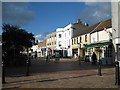

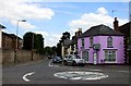
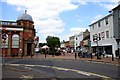

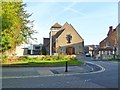


100 photos from this area
Area Information
Key information about the OX26 6BG including its size, population, and administrative classification.
- Area Type
- Postcode
- Area Size
- 5330 m²
- Population
- 1228
- Population Density
- 1374 people/km²
House Prices in OX26 6BG
17
Properties
£325,714
Average Sold Price
£229,950
Lowest Price
£470,000
Highest Price
Showing 17 properties
| Address | Type | Beds | Baths | Last Sale Price | Last Sale Date | |
|---|---|---|---|---|---|---|
| The Old Stable Barn, Priory Lane, Bicester, OX26 6BG | Semi-detached | 2 | 1 | £291,332 | Jul 2025 | |
| The Old Stable Forge, Priory Lane, Bicester, OX26 6BG | Semi-detached | 2 | - | £340,000 | Feb 2016 | |
| Old School Lodge, Priory Lane, Bicester, OX26 6BG | Detached | 3 | 3 | £315,000 | Mar 2014 | |
| The Sanctuary, Priory Lane, Bicester, OX26 6BG | Semi-detached | 2 | - | £470,000 | Jun 2012 | |
| Priory Barn, Priory Lane, Bicester, OX26 6BG | house | - | - | £308,000 | Dec 2009 | |
| The Old School House, Priory Lane, Bicester, OX26 6BG | Detached | 4 | 2 | £229,950 | Aug 2001 | |
| 1 Priory Lane, Bicester, OX26 6BG | Cottage | 3 | 1 | - | - | |
| 3, Flat 6, The Priory, Priory Lane, Bicester, OX26 6BG | Flat | - | - | - | - | |
| 3, Flat 5, The Priory, Priory Lane, Bicester, OX26 6BG | Flat | - | - | - | - | |
| 3, Flat 2, The Priory, Priory Lane, Bicester, OX26 6BG | Flat | 2 | 1 | - | - |
Page 1 of 2
Energy Efficiency in OX26 6BG
Amenities
Schools
| Rank | School | Type | Entry gender | Ages |
|---|
Explore more schools in this area
Go to Schools tabDemographics
Household Size
Family (3-5 people)
most common
Accommodation Type
Houses
most common
Tenure
66
majority
Ethnic Group
White
most common
Religion
N/A
most common
Household Composition
N/A
most common
Age
47
median
Adults (30-64 years)
most common
Household Deprivation
N/A
with no deprivation
NS-SEC
48
in Lower managerial occupations
Explore more demographic insights in this area
Go to Demographics tabPlanning
Planning Constraints
- Flood RiskPremium
- Ramsar Wetland SitesPremium
- Area of Outstanding Natural BeautyPremium
- Protected Nature ReservePremium
- Protected WoodlandPremium