Area Overview for OX26 4QZ
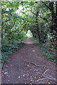
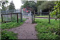
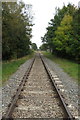
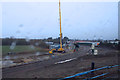
Photos of OX26 4QZ


Area Information
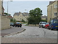
OX26 4QZ is a compact residential postcode cluster covering just 3.3 hectares within Oxfordshire. You are stepping into a dense environment where nearly 4,500 people live per square kilometre of this specific zone. The population stands at exactly 1,493 residents, creating a tightly knit community feel despite the high density. Living in OX26 4QZ means relying on a small, concentrated footprint where every local street relationship counts. This postcode is distinctively small, yet it forms a significant part of the larger Bicester neighbourhood network. The area operates as a quiet pocket of the wider Ox26 region, offering a specific residential experience defined by its limited land area. You will find yourself in a place where proximity defines life, with all services and neighbours within close travel distance. The character of OX26 4QZ is shaped by its sheer size; it is a micro-community where the edges of your garden may border another family's home.
- Area Type
- Postcode
- Area Size
- 3.3 hectares
- Population
- 1493
- Population Density
- 44802 people/km²
Homes in OX26 4QZ form a market defined almost exclusively by private ownership. The data shows that 84% of the housing stock is owner-occupied, which creates a very different buying landscape compared to high-rent districts. You will primarily encounter houses as the predominant accommodation type within this postcode. This means the area is built around traditional family properties rather than flats or apartments. The high ownership rate suggests that existing residents are likely protective of their immediate neighbourhood character. For a buyer, this indicates a purchase market where local established buyers drive value. You are not competing with institutional landlords for these properties, which often stabilises prices. The fact that this is a small 3.3-hectare cluster means every property carries significant individual weight. When considering schools near OX26 4QZ, remember the buyer base is settled homeowners who value stability. This demographic holds onto homes long-term, reducing turnover and creating a predictable market environment for those seeking a permanent residence.
House Prices in OX26 4QZ
No properties found in this postcode.
Energy Efficiency in OX26 4QZ
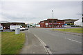
Living in OX26 4QZ offers convenient access to major retail and transport hubs despite the small size of the cluster. You have five key retail locations within practical reach, including Iceland Bicester, Lidl Southwold, and Aldi Bicester. These supermarkets provide all the groceries and daily essentials you need without needing to travel far. Transport links are equally accessible, with two rail stations positioning the area well for commuting. Bicester North Railway Station and Bicester Village Railway Station offer quick connections to the wider network. The presence of Iceland Bicester ensures you can fil your shopping basket immediately after work or school runs. Using Lidl Southwold means you can find budget-friendly options nearby. Bicester North and Bicester Village stations allow you to link to London or Oxford with relative ease. Your daily life in OX26 4QZ is supported by these specific, named amenities that are close enough for a quick walk or short drive. You have the best of the wider village network without the crowds.
Amenities
Schools
| Rank | School | Type | Entry gender | Ages |
|---|
Explore more schools in this area
Go to Schools tabDemographics
The community within OX26 4QZ is overwhelmingly settled, with a median age of 47 years. Most people in this area fall within the adult age range of 30 to 64 years, suggesting a stable population with established roots. Home ownership is the dominant accommodation type, confirmed by a striking 84% figure for owner-occupied homes. This high rate indicates long-term residents who have put down roots rather than transient renters. The predominant ethnic group is White, reflecting the established nature of this housing cluster. You are looking at an area where families and older professionals likely own their properties outright. The high ownership figure means decisions regarding local improvements remain in the hands of residents. There is a strong sense of permanence here, driven by the fact that less than one in six homes is rented. This demographic profile supports a quiet, community-focused atmosphere where neighbours know each other well over decades.
Household Size
Accommodation Type
Tenure
Ethnic Group
Religion
Household Composition
Age
Household Deprivation
NS-SEC
Explore more demographic insights in this area
Go to Demographics tabPlanning
Planning Constraints
- Flood RiskPremium
- Ramsar Wetland SitesPremium
- Area of Outstanding Natural BeautyPremium
- Protected Nature ReservePremium
- Protected WoodlandPremium
- Crime RiskPremium