Area Overview for OX26 3YD
Photos of OX26 3YD
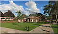
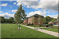
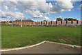
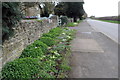
29 photos from this area
Area Information
Key information about the OX26 3YD including its size, population, and administrative classification.
- Area Type
- Postcode
- Area Size
- 2935 m²
- Population
- 1442
- Population Density
- 7188 people/km²
House Prices in OX26 3YD
17
Properties
£167,287
Average Sold Price
£65,000
Lowest Price
£269,500
Highest Price
Showing 17 properties
| Address | Type | Beds | Baths | Last Sale Price | Last Sale Date | |
|---|---|---|---|---|---|---|
| 5 Honeysuckle Close, Bicester, OX26 3YD | Terraced | 1 | 1 | £190,090 | Jul 2025 | |
| 11 Honeysuckle Close, Bicester, OX26 3YD | Terraced | 2 | 1 | £269,500 | Oct 2023 | |
| 1 Honeysuckle Close, Bicester, OX26 3YD | Terraced | 2 | - | £267,000 | Jul 2017 | |
| 9 Honeysuckle Close, Bicester, OX26 3YD | Terraced | 2 | 1 | £245,000 | Mar 2017 | |
| 13 Honeysuckle Close, Bicester, OX26 3YD | house | 2 | 1 | £248,000 | Dec 2016 | |
| 2 Honeysuckle Close, Bicester, OX26 3YD | Terraced | 3 | - | £196,000 | Feb 2013 | |
| 18 Honeysuckle Close, Bicester, OX26 3YD | Semi-detached | 2 | 1 | £163,000 | Mar 2012 | |
| 4 Honeysuckle Close, Bicester, OX26 3YD | house | - | - | £125,000 | Dec 2009 | |
| 14 Honeysuckle Close, Bicester, OX26 3YD | Terraced | 2 | 1 | £154,000 | Sep 2009 | |
| 2A Honeysuckle Close, Bicester, OX26 3YD | Terraced | 1 | - | £112,000 | Oct 2008 |
Page 1 of 2
Energy Efficiency in OX26 3YD
Amenities
Schools
| Rank | School | Type | Entry gender | Ages |
|---|
Explore more schools in this area
Go to Schools tabDemographics
Household Size
Two person
most common
Accommodation Type
Houses
most common
Tenure
60
majority
Ethnic Group
White
most common
Religion
N/A
most common
Household Composition
N/A
most common
Age
47
median
Adults (30-64 years)
most common
Household Deprivation
N/A
with no deprivation
NS-SEC
36
in Lower managerial occupations
Explore more demographic insights in this area
Go to Demographics tabPlanning
Planning Constraints
- Flood RiskPremium
- Ramsar Wetland SitesPremium
- Area of Outstanding Natural BeautyPremium
- Protected Nature ReservePremium
- Protected WoodlandPremium