Area Overview for OX26 3WD
Photos of OX26 3WD
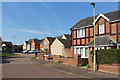
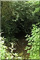
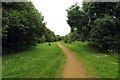
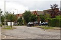
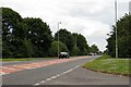
14 photos from this area
Area Information
Key information about the OX26 3WD including its size, population, and administrative classification.
- Area Type
- Postcode
- Area Size
- 9897 m²
- Population
- 2047
- Population Density
- 5082 people/km²
House Prices in OX26 3WD
21
Properties
£346,095
Average Sold Price
£213,000
Lowest Price
£545,000
Highest Price
Showing 21 properties
| Address | Type | Beds | Baths | Last Sale Price | Last Sale Date | |
|---|---|---|---|---|---|---|
| 55 Germander Way, Bicester, OX26 3WD | Detached | 3 | 3 | £440,000 | Mar 2025 | |
| 38 Germander Way, Bicester, OX26 3WD | Detached | 4 | 2 | £510,000 | Feb 2025 | |
| 51 Germander Way, Bicester, OX26 3WD | Detached | 4 | 2 | £495,000 | Sep 2022 | |
| 75 Germander Way, Bicester, OX26 3WD | house | - | - | £545,000 | Nov 2021 | |
| 67 Germander Way, Bicester, OX26 3WD | Detached | 4 | 2 | £430,000 | Sep 2020 | |
| 57 Germander Way, Bicester, OX26 3WD | Detached | 3 | 2 | £320,000 | Jun 2019 | |
| 65 Germander Way, Bicester, OX26 3WD | Detached | 4 | 3 | £460,000 | Aug 2016 | |
| 77 Germander Way, Bicester, OX26 3WD | Detached | 4 | 3 | £400,000 | Jan 2016 | |
| 50 Germander Way, Bicester, OX26 3WD | Detached | 4 | 3 | £375,000 | May 2015 | |
| 69 Germander Way, Bicester, OX26 3WD | Detached | 4 | 3 | £290,000 | Apr 2014 |
Page 1 of 3
Energy Efficiency in OX26 3WD
Amenities
Schools
| Rank | School | Type | Entry gender | Ages |
|---|
Explore more schools in this area
Go to Schools tabDemographics
Household Size
Family (3-5 people)
most common
Accommodation Type
Houses
most common
Tenure
76
majority
Ethnic Group
White
most common
Religion
N/A
most common
Household Composition
N/A
most common
Age
47
median
Adults (30-64 years)
most common
Household Deprivation
N/A
with no deprivation
NS-SEC
47
in Lower managerial occupations
Explore more demographic insights in this area
Go to Demographics tabPlanning
Planning Constraints
- Flood RiskPremium
- Ramsar Wetland SitesPremium
- Area of Outstanding Natural BeautyPremium
- Protected Nature ReservePremium
- Protected WoodlandPremium