Area Overview for OX26 3UA
Photos of OX26 3UA


Area Information
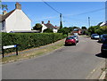
OX26 3UA represents a specific residential cluster within the Oxfordshire postcode geography, housing a population of 1,660 people. This compact community offers a quiet existence for those seeking a settled environment away from the city centre. The area functions as a cohesive neighbourhood where daily life revolves around a defined set of local amenities and transport links. Residents here experience typical suburban rhythms, balancing work commutes with leisure time in the surrounding Berkshire-Oxford corridor. Living in this specific postcode means you are situated within a cluster that prioritises residential use, supported by nearby rail stations and essential retail outlets. The population size indicates a tightly knit community rather than a sprawling urban district. You will find the area is well-defined by its postal boundaries, which encompass houses suitable for families or downsizers looking for stability. Exploring homes in OX26 3UA reveals an environment where the immediate surroundings are tailored to domestic life. The area avoids the congestion of larger towns while maintaining access to the broader Oxfordshire infrastructure. This balance makes it a practical choice for individuals who value proximity to services without the noise of high-density living zones.
- Area Type
- Postcode
- Area Size
- Not available
- Population
- 1660
- Population Density
- 6150 people/km²
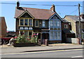
The property market in OX26 3UA is characterised by a strong preference for traditional housing stock. With 62% of the population owning their homes, this area functions primarily as an owner-occupied environment rather than a rental market. The predominant accommodation type consists of houses, which suits the demographic makeup of adults aged 30 to 64 years. Buying into this cluster means purchasing a detached or semi-detached dwelling designed for family living rather than high-rise flats. This housing profile aligns well with the area's median age of 47 years, where buyers often seek larger gardens and multiple bedrooms. Homes in OX26 3UA are likely suited for those moving away from city centre density towards suburban tranquility. The high home ownership percentage suggests a market where sellers often have a stake in the location's long-term development and maintenance. Potential buyers should consider that properties here cater to established families needing space for growing children or down-sizing residents seeking maintenance-free living. The nature of the housing stock supports the perception of this postcode as a stable, residential sanctuary within the wider Oxford region.
House Prices in OX26 3UA
No properties found in this postcode.
Energy Efficiency in OX26 3UA
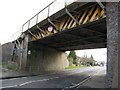
Daily life in OX26 3UA benefits from five accessible retail outlets, ensuring essential shopping needs are met without extensive travel. Residents can choose between Tesco Southwold, Co-op Buckingham Road, and Co-op Barberry for groceries and household essentials, with two further stores present in the cluster. These venues provide a convenient mix of sustainable and general merchandise options directly reachable by car or active travel. For rail commuters, Bicester North Railway Station and Bicester Village Railway Station offer convenient departure points for business and leisure trips. These stations integrate seamlessly into the regular routine of those living in this postcode. The local commercial environment is defined by practicality, with shops designed to serve the 1,660 residents efficiently. Dining and leisure options are concentrated within walking distance or a short drive from your home. Shopping near OX26 3UA is straightforward, with no need for journeying into Oxford city centre for basic requirements. The presence of these specific retail chains supports a self-sufficient local lifestyle where you manage daily errands within a short radius.
Amenities
Schools
Bure Park Primary School serves the educational needs of young families residing in this cluster. The school offers primary-level education and holds an Ofsted rating of good. This rating signifies standards that meet government expectations for curriculum delivery and student care, providing reassurance to parents selecting homes near OX26 3UA. With only one primary school listed in the immediate vicinity, educational planning requires looking slightly further afield for secondary education. Children in OX26 3UA will spend their early years at Bure Park Primary School, establishing strong local connections from an early age. The presence of a good-rated primary institution supports the area's appeal to families within the 30-64 age bracket identified in local demographics. Living in this postcode means your children receive education within a recognised quality framework, though secondary options are located beyond the immediate boundary. The single primary school option indicates a community where families coordinate their planning around this central institution. Schools near OX26 3UA are limited to this primary provider, requiring drivers to commute for older students.
| Rank | School | Type | Entry gender | Ages |
|---|
Explore more schools in this area
Go to Schools tabDemographics
The community profile in OX26 3UA reflects a mature demographic with a median age of 47 years. Adults between 30 and 64 years constitute the most common age range within this population. This concentration suggests an area populated by established households, likely comprising families and long-term residents who have remained in the location for significant periods. Home ownership stands at 62%, indicating that the majority of residents purchased their properties rather than renting. This high ownership rate typically correlates with greater stability and a deeper investment in the local community fabric. Accommodation types are predominantly houses, distinguishing this area from estates dominated by flats or terraced housing. The predominant ethnic group is White, which aligns with the broader demographic trends of the surrounding Oxfordshire countryside. Living in OX26 3UA means joining a neighbourhood where life stages are focused on adulthood and established family units. The age distribution creates an environment where children require education and older adults may be approaching retirement planning. You can expect neighbours who are familiar with local issues and invested in the maintenance of the local streets.
Household Size
Accommodation Type
Tenure
Ethnic Group
Religion
Household Composition
Age
Household Deprivation
NS-SEC
Explore more demographic insights in this area
Go to Demographics tabPlanning
Planning Constraints
- Flood RiskPremium
- Ramsar Wetland SitesPremium
- Area of Outstanding Natural BeautyPremium
- Protected Nature ReservePremium
- Protected WoodlandPremium