Area Overview for OX26 2XA
Photos of OX26 2XA
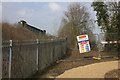
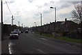
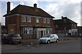
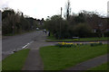
44 photos from this area
Area Information
Key information about the OX26 2XA including its size, population, and administrative classification.
- Area Type
- Postcode
- Area Size
- 6559 m²
- Population
- 1426
- Population Density
- 3691 people/km²
House Prices in OX26 2XA
11
Properties
£316,033
Average Sold Price
£92,083
Lowest Price
£500,000
Highest Price
Showing 11 properties
| Address | Type | Beds | Baths | Last Sale Price | Last Sale Date | |
|---|---|---|---|---|---|---|
| 10 Burns Crescent, Bicester, OX26 2XA | Detached | 3 | 1 | £500,000 | Oct 2025 | |
| 18 Burns Crescent, Bicester, OX26 2XA | Detached | 3 | 1 | £475,000 | Mar 2025 | |
| 3 Burns Crescent, Bicester, OX26 2XA | house | - | - | £450,000 | Mar 2021 | |
| 11 Burns Crescent, Bicester, OX26 2XA | house | - | - | £390,000 | Jul 2019 | |
| 16 Burns Crescent, Bicester, OX26 2XA | Detached | 3 | 2 | £330,000 | Feb 2018 | |
| 14 Burns Crescent, Bicester, OX26 2XA | Detached | 4 | 2 | £320,000 | Oct 2014 | |
| 9 Burns Crescent, Bicester, OX26 2XA | house | - | - | £242,500 | Sep 2011 | |
| 7 Burns Crescent, Bicester, OX26 2XA | house | - | - | £92,083 | Apr 2009 | |
| 5 Burns Crescent, Bicester, OX26 2XA | house | - | - | £243,000 | Nov 2005 | |
| 8 Burns Crescent, Bicester, OX26 2XA | Detached | 4 | 2 | £117,750 | Jul 1998 |
Page 1 of 2
Energy Efficiency in OX26 2XA
Amenities
Schools
| Rank | School | Type | Entry gender | Ages |
|---|
Explore more schools in this area
Go to Schools tabDemographics
Household Size
Two person
most common
Accommodation Type
Houses
most common
Tenure
89
majority
Ethnic Group
White
most common
Religion
N/A
most common
Household Composition
N/A
most common
Age
47
median
Adults (30-64 years)
most common
Household Deprivation
N/A
with no deprivation
NS-SEC
34
in Lower managerial occupations
Explore more demographic insights in this area
Go to Demographics tabPlanning
Planning Constraints
- Flood RiskPremium
- Ramsar Wetland SitesPremium
- Area of Outstanding Natural BeautyPremium
- Protected Nature ReservePremium
- Protected WoodlandPremium