Area Overview for OX26 2FF
Photos of OX26 2FF

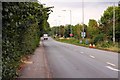
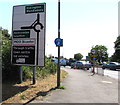
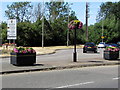
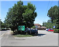
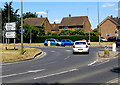
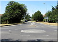
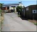
25 photos from this area
Area Information
Key information about the OX26 2FF including its size, population, and administrative classification.
- Area Type
- Postcode
- Area Size
- 2.0 hectares
- Population
- 1205
- Population Density
- 5574 people/km²
House Prices in OX26 2FF
40
Properties
£209,016
Average Sold Price
£46,000
Lowest Price
£379,600
Highest Price
Showing 40 properties
| Address | Type | Beds | Baths | Last Sale Price | Last Sale Date | |
|---|---|---|---|---|---|---|
| 39 Wear Road, Bicester, OX26 2FF | Terraced | 3 | 1 | £288,000 | May 2025 | |
| 42 Wear Road, Bicester, OX26 2FF | Bungalow | 3 | 2 | £379,600 | Nov 2024 | |
| 59 Wear Road, Bicester, OX26 2FF | Bungalow | 2 | 1 | £315,000 | Feb 2024 | |
| 40 Wear Road, Bicester, OX26 2FF | Terraced | 3 | 1 | £300,000 | Jan 2024 | |
| 48 Wear Road, Bicester, OX26 2FF | Terraced | 3 | 1 | £307,000 | Aug 2023 | |
| 43 Wear Road, Bicester, OX26 2FF | Bungalow | 2 | - | £285,000 | Jan 2022 | |
| 62 Wear Road, Bicester, OX26 2FF | Bungalow | 2 | 1 | £260,000 | Nov 2021 | |
| 60 Wear Road, Bicester, OX26 2FF | Bungalow | 3 | 1 | £317,500 | Jun 2021 | |
| 53 Wear Road, Bicester, OX26 2FF | Detached | 3 | 2 | £280,000 | Jun 2019 | |
| 71 Wear Road, Bicester, OX26 2FF | Detached | 3 | 2 | £350,000 | Aug 2018 |
Page 1 of 4
Energy Efficiency in OX26 2FF
Amenities
Schools
| Rank | School | Type | Entry gender | Ages |
|---|
Explore more schools in this area
Go to Schools tabDemographics
Household Size
Family (3-5 people)
most common
Accommodation Type
Houses
most common
Tenure
84
majority
Ethnic Group
White
most common
Religion
N/A
most common
Household Composition
N/A
most common
Age
47
median
Adults (30-64 years)
most common
Household Deprivation
N/A
with no deprivation
NS-SEC
30
in Lower managerial occupations
Explore more demographic insights in this area
Go to Demographics tabPlanning
Planning Constraints
- Flood RiskPremium
- Ramsar Wetland SitesPremium
- Area of Outstanding Natural BeautyPremium
- Protected Nature ReservePremium
- Protected WoodlandPremium