Area Overview for OX26 1UW
Photos of OX26 1UW
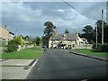
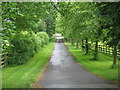
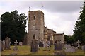
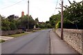
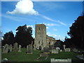
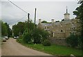
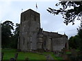
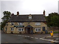
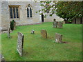


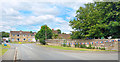
33 photos from this area
Area Information
Key information about the OX26 1UW including its size, population, and administrative classification.
- Area Type
- Postcode
- Area Size
- 3.5 hectares
- Population
- 1883
- Population Density
- 77 people/km²
House Prices in OX26 1UW
27
Properties
£455,500
Average Sold Price
£112,000
Lowest Price
£925,000
Highest Price
Showing 27 properties
| Address | Type | Beds | Baths | Last Sale Price | Last Sale Date | |
|---|---|---|---|---|---|---|
| Amber Cottage, Alchester Road, Chesterton, OX26 1UW | Cottage | 3 | 2 | £487,500 | Nov 2023 | |
| Mellow Stones, Alchester Road, Chesterton, OX26 1UW | Bungalow | 4 | 3 | £760,000 | Aug 2023 | |
| Sadlers Cottage, Alchester Road, Chesterton, OX26 1UW | Semi-detached | 4 | 3 | £925,000 | Aug 2022 | |
| March Hares, Alchester Road, Chesterton, OX26 1UW | Detached | 2 | 1 | £395,000 | Sep 2019 | |
| 37 Alchester Road, Chesterton, OX26 1UW | Detached | 5 | 2 | £410,000 | Feb 2015 | |
| Strathmore, Alchester Road, Chesterton, OX26 1UW | Semi-detached | 3 | 2 | £425,000 | Feb 2014 | |
| Ivy Cottage, Alchester Road, Chesterton, OX26 1UW | Detached | - | - | £515,000 | Jul 2008 | |
| Old Vicarage Cottage, Alchester Road, Chesterton, OX26 1UW | Semi-detached | - | - | £270,000 | Dec 2006 | |
| Thatchover, Alchester Road, Chesterton, OX26 1UW | Cottage | 4 | - | £495,000 | Apr 2004 | |
| Haywards Cottage, Alchester Road, Chesterton, OX26 1UW | house | 2 | - | £112,000 | May 1998 |
Page 1 of 3
Energy Efficiency in OX26 1UW
Amenities
Schools
| Rank | School | Type | Entry gender | Ages |
|---|
Explore more schools in this area
Go to Schools tabDemographics
Household Size
Two person
most common
Accommodation Type
Houses
most common
Tenure
79
majority
Ethnic Group
White
most common
Religion
N/A
most common
Household Composition
N/A
most common
Age
47
median
Adults (30-64 years)
most common
Household Deprivation
N/A
with no deprivation
NS-SEC
48
in Lower managerial occupations
Explore more demographic insights in this area
Go to Demographics tabPlanning
Planning Constraints
- Flood RiskPremium
- Ramsar Wetland SitesPremium
- Area of Outstanding Natural BeautyPremium
- Protected Nature ReservePremium
- Protected WoodlandPremium