Area Overview for OX26 1UQ
Photos of OX26 1UQ
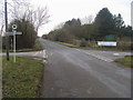
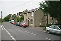
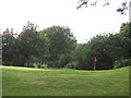
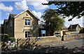
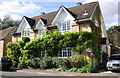
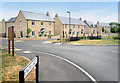
22 photos from this area
Area Information
Key information about the OX26 1UQ including its size, population, and administrative classification.
- Area Type
- Postcode
- Area Size
- 2.7 hectares
- Population
- 1883
- Population Density
- 77 people/km²
House Prices in OX26 1UQ
14
Properties
£557,286
Average Sold Price
£300,000
Lowest Price
£990,000
Highest Price
Showing 14 properties
| Address | Type | Beds | Baths | Last Sale Price | Last Sale Date | |
|---|---|---|---|---|---|---|
| Corner Cottage, Bignell View, Chesterton, OX26 1UQ | Detached | 4 | 2 | £990,000 | Mar 2025 | |
| Squirrel Cottage, Bignell View, Chesterton, OX26 1UQ | Semi-detached | 3 | 2 | £395,000 | May 2023 | |
| Plum Tree Cottage, Bignell View, Chesterton, OX26 1UQ | Semi-detached | 3 | 1 | £400,000 | May 2023 | |
| Top Green Cottage, Alchester Road, Chesterton, OX26 1UQ | house | 4 | - | £585,000 | Dec 2019 | |
| West Green Cottage, Bignell View, Chesterton, OX26 1UQ | house | - | - | £300,000 | Oct 2019 | |
| Hillside Cottage, Bignell View, Chesterton, OX26 1UQ | Detached | 3 | 1 | £556,000 | Apr 2018 | |
| Vicarage Farm House, Alchester Road, Chesterton, OX26 1UQ | Detached | - | - | £675,000 | May 2004 | |
| Swallow Barn, Alchester Road, Chesterton, OX26 1UQ | Detached | - | - | - | - | |
| The Old Post Office, Bignell View, Chesterton, OX26 1UQ | Detached | - | - | - | - | |
| Yew Tree Cottage, Bignell View, Chesterton, OX26 1UQ | Semi-detached | 2 | 1 | - | - |
Page 1 of 2
Energy Efficiency in OX26 1UQ
Amenities
Schools
| Rank | School | Type | Entry gender | Ages |
|---|
Explore more schools in this area
Go to Schools tabDemographics
Household Size
Two person
most common
Accommodation Type
Houses
most common
Tenure
79
majority
Ethnic Group
White
most common
Religion
N/A
most common
Household Composition
N/A
most common
Age
47
median
Adults (30-64 years)
most common
Household Deprivation
N/A
with no deprivation
NS-SEC
48
in Lower managerial occupations
Explore more demographic insights in this area
Go to Demographics tabPlanning
Planning Constraints
- Flood RiskPremium
- Ramsar Wetland SitesPremium
- Area of Outstanding Natural BeautyPremium
- Protected Nature ReservePremium
- Protected WoodlandPremium