Area Overview for OX26 1BG
Photos of OX26 1BG
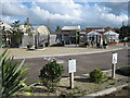

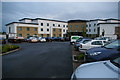
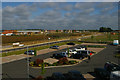
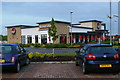
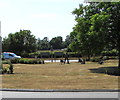
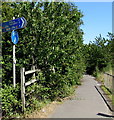
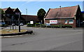
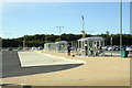
31 photos from this area
Area Information
Key information about the OX26 1BG including its size, population, and administrative classification.
- Area Type
- Postcode
- Area Size
- 3.6 hectares
- Population
- 1702
- Population Density
- 3500 people/km²
House Prices in OX26 1BG
51
Properties
£388,332
Average Sold Price
£244,995
Lowest Price
£466,995
Highest Price
Showing 51 properties
| Address | Type | Beds | Baths | Last Sale Price | Last Sale Date | |
|---|---|---|---|---|---|---|
| 4 Haydock Road, Bicester, OX26 1BG | Semi-detached | 3 | 2 | £365,000 | Feb 2021 | |
| 20 Haydock Road, Bicester, OX26 1BG | house | - | - | £425,000 | Jan 2021 | |
| 102 Haydock Road, Bicester, OX26 1BG | Semi-detached | 4 | 2 | £410,000 | Jan 2021 | |
| 74 Haydock Road, Bicester, OX26 1BG | house | 3 | 2 | £375,000 | Dec 2020 | |
| 92 Haydock Road, Bicester, OX26 1BG | Detached | 3 | 2 | £313,000 | Jul 2019 | |
| 12 Haydock Road, Bicester, OX26 1BG | Detached | 2 | 1 | £435,000 | Mar 2019 | |
| 42 Haydock Road, Bicester, OX26 1BG | Semi-detached | 4 | 3 | £415,000 | Aug 2017 | |
| 84 Haydock Road, Bicester, OX26 1BG | Detached | 4 | 3 | £413,000 | Jan 2017 | |
| 90 Haydock Road, Bicester, OX26 1BG | Flat | 2 | 1 | £244,995 | Aug 2016 | |
| 94 Haydock Road, Bicester, OX26 1BG | Detached | 3 | 2 | £341,995 | Apr 2016 |
Page 1 of 6
Energy Efficiency in OX26 1BG
Amenities
Schools
| Rank | School | Type | Entry gender | Ages |
|---|
Explore more schools in this area
Go to Schools tabDemographics
Household Size
Family (3-5 people)
most common
Accommodation Type
Houses
most common
Tenure
67
majority
Ethnic Group
White
most common
Religion
N/A
most common
Household Composition
N/A
most common
Age
47
median
Adults (30-64 years)
most common
Household Deprivation
N/A
with no deprivation
NS-SEC
52
in Lower managerial occupations
Explore more demographic insights in this area
Go to Demographics tabPlanning
Planning Constraints
- Flood RiskPremium
- Ramsar Wetland SitesPremium
- Area of Outstanding Natural BeautyPremium
- Protected Nature ReservePremium
- Protected WoodlandPremium