Area Overview for OX20 1XL
Photos of OX20 1XL
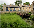
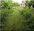
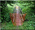
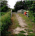
69 photos from this area
Area Information
Key information about the OX20 1XL including its size, population, and administrative classification.
- Area Type
- Postcode
- Area Size
- 6221 m²
- Population
- 1306
- Population Density
- 3403 people/km²
House Prices in OX20 1XL
12
Properties
£631,700
Average Sold Price
£134,000
Lowest Price
£1,855,000
Highest Price
Showing 12 properties
| Address | Type | Beds | Baths | Last Sale Price | Last Sale Date | |
|---|---|---|---|---|---|---|
| 94 Manor Road, Woodstock, OX20 1XL | Detached | 3 | 2 | £905,000 | Jun 2025 | |
| Brightside House, 92 Manor Road, Woodstock, OX20 1XL | house | 3 | 2 | £760,000 | May 2018 | |
| Beech Tree House, 86 Manor Road, Woodstock, OX20 1XL | Detached | 3 | 3 | £540,000 | Dec 2017 | |
| Kissing Gate Cottage, 66 Manor Road, Woodstock, OX20 1XL | Terraced | 3 | - | £345,000 | Sep 2016 | |
| 98 Manor Road, Woodstock, OX20 1XL | house | - | - | £915,000 | Jul 2015 | |
| 80 Manor Road, Woodstock, OX20 1XL | Detached | 6 | 1 | £1,855,000 | Nov 2014 | |
| 64 Manor Road, Woodstock, OX20 1XL | Terraced | 4 | - | £305,000 | Jul 2014 | |
| 88 Manor Road, Woodstock, OX20 1XL | Cottage | 4 | - | £348,000 | May 2013 | |
| 70 Manor Road, Woodstock, OX20 1XL | Terraced | 2 | 1 | £210,000 | May 2010 | |
| Trinity Cottage, 68 Manor Road, Woodstock, OX20 1XL | Cottage | 2 | 1 | £134,000 | Jun 2001 |
Page 1 of 2
Energy Efficiency in OX20 1XL
Amenities
Schools
| Rank | School | Type | Entry gender | Ages |
|---|
Explore more schools in this area
Go to Schools tabDemographics
Household Size
One person
most common
Accommodation Type
Houses
most common
Tenure
65
majority
Ethnic Group
White
most common
Religion
N/A
most common
Household Composition
N/A
most common
Age
47
median
Adults (30-64 years)
most common
Household Deprivation
N/A
with no deprivation
NS-SEC
52
in Lower managerial occupations
Explore more demographic insights in this area
Go to Demographics tabPlanning
Planning Constraints
- Flood RiskPremium
- Ramsar Wetland SitesPremium
- Area of Outstanding Natural BeautyPremium
- Protected Nature ReservePremium
- Protected WoodlandPremium