Area Overview for OX20 1UH
Photos of OX20 1UH


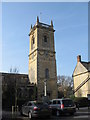

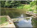
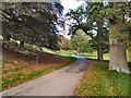
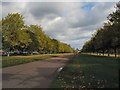

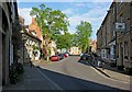
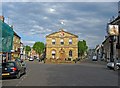
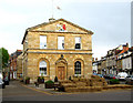
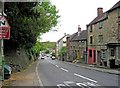
100 photos from this area
Area Information
Key information about the OX20 1UH including its size, population, and administrative classification.
- Area Type
- Postcode
- Area Size
- 2.8 hectares
- Population
- 1304
- Population Density
- 98 people/km²
House Prices in OX20 1UH
37
Properties
£248,269
Average Sold Price
£30,000
Lowest Price
£470,000
Highest Price
Showing 37 properties
| Address | Type | Beds | Baths | Last Sale Price | Last Sale Date | |
|---|---|---|---|---|---|---|
| 30 Cockpit Close, Woodstock, OX20 1UH | Flat | 3 | 1 | £325,000 | Jan 2025 | |
| 31 Cockpit Close, Woodstock, OX20 1UH | Flat | - | - | £267,000 | Mar 2023 | |
| 14 Cockpit Close, Woodstock, OX20 1UH | Flat | - | - | £119,000 | Sep 2022 | |
| 1 Cockpit Close, Woodstock, OX20 1UH | house | - | - | £470,000 | Jun 2021 | |
| 32 Cockpit Close, Woodstock, OX20 1UH | Flat | - | - | £262,500 | Jun 2021 | |
| 7 Cockpit Close, Woodstock, OX20 1UH | Flat | - | - | £197,500 | Feb 2019 | |
| 15 Cockpit Close, Woodstock, OX20 1UH | Terraced | 4 | - | £405,000 | Jun 2018 | |
| 27 Cockpit Close, Woodstock, OX20 1UH | Terraced | 3 | - | £365,000 | Sep 2017 | |
| 28 Cockpit Close, Woodstock, OX20 1UH | Flat | - | - | £30,000 | Mar 2017 | |
| 33 Cockpit Close, Woodstock, OX20 1UH | Flat | 3 | 1 | £195,000 | Apr 2015 |
Page 1 of 4
Energy Efficiency in OX20 1UH
Amenities
Schools
| Rank | School | Type | Entry gender | Ages |
|---|
Explore more schools in this area
Go to Schools tabDemographics
Household Size
Two person
most common
Accommodation Type
Houses
most common
Tenure
73
majority
Ethnic Group
White
most common
Religion
N/A
most common
Household Composition
N/A
most common
Age
47
median
Adults (30-64 years)
most common
Household Deprivation
N/A
with no deprivation
NS-SEC
59
in Lower managerial occupations
Explore more demographic insights in this area
Go to Demographics tabPlanning
Planning Constraints
- Flood RiskPremium
- Ramsar Wetland SitesPremium
- Area of Outstanding Natural BeautyPremium
- Protected Nature ReservePremium
- Protected WoodlandPremium