Area Overview for OX2 9QP
Photos of OX2 9QP
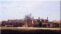
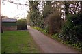
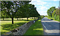
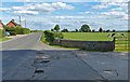

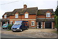


23 photos from this area
Area Information
Key information about the OX2 9QP including its size, population, and administrative classification.
- Area Type
- Postcode
- Area Size
- 9096 m²
- Population
- 2100
- Population Density
- 658 people/km²
House Prices in OX2 9QP
12
Properties
£299,500
Average Sold Price
£145,000
Lowest Price
£495,000
Highest Price
Showing 12 properties
| Address | Type | Beds | Baths | Last Sale Price | Last Sale Date | |
|---|---|---|---|---|---|---|
| 11 Kenilworth Road, Cumnor, Oxford, OX2 9QP | Semi-detached | 2 | 1 | £365,000 | Feb 2025 | |
| 2B Kenilworth Road, Cumnor, Oxford, OX2 9QP | Terraced | 2 | 1 | £330,000 | Dec 2022 | |
| 3 Kenilworth Road, Cumnor, Oxford, OX2 9QP | Bungalow | - | - | £440,000 | Jun 2021 | |
| 2A Kenilworth Road, Cumnor, Oxford, OX2 9QP | Flat | 1 | 1 | £245,000 | Feb 2021 | |
| 4 Kenilworth Road, Cumnor, Oxford, OX2 9QP | Detached | 4 | 1 | £495,000 | Feb 2020 | |
| 15 Kenilworth Road, Cumnor, Oxford, OX2 9QP | Semi-detached | 2 | 1 | £280,000 | Jan 2016 | |
| 2 Kenilworth Road, Cumnor, Oxford, OX2 9QP | Flat | 2 | - | £250,000 | Jul 2015 | |
| 5 Kenilworth Road, Cumnor, Oxford, OX2 9QP | Bungalow | 2 | 1 | £265,000 | Jul 2014 | |
| 7 Kenilworth Road, Cumnor, Oxford, OX2 9QP | Bungalow | - | - | £145,000 | Aug 1997 | |
| 9 Kenilworth Road, Cumnor, Oxford, OX2 9QP | Detached | - | - | £180,000 | Sep 1996 |
Page 1 of 2
Energy Efficiency in OX2 9QP
Amenities
Schools
| Rank | School | Type | Entry gender | Ages |
|---|
Explore more schools in this area
Go to Schools tabDemographics
Household Size
Family (3-5 people)
most common
Accommodation Type
Houses
most common
Tenure
82
majority
Ethnic Group
White
most common
Religion
N/A
most common
Household Composition
N/A
most common
Age
47
median
Adults (30-64 years)
most common
Household Deprivation
N/A
with no deprivation
NS-SEC
55
in Lower managerial occupations
Explore more demographic insights in this area
Go to Demographics tabPlanning
Planning Constraints
- Flood RiskPremium
- Ramsar Wetland SitesPremium
- Area of Outstanding Natural BeautyPremium
- Protected Nature ReservePremium
- Protected WoodlandPremium