Area Overview for OX2 9QD
Photos of OX2 9QD
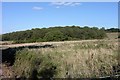
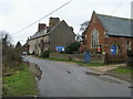
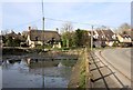
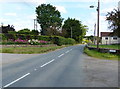
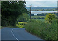
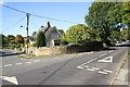
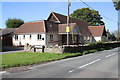
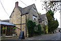
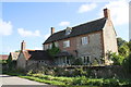
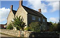
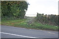
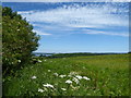
32 photos from this area
Area Information
Key information about the OX2 9QD including its size, population, and administrative classification.
- Area Type
- Postcode
- Area Size
- 12.0 hectares
- Population
- 1687
- Population Density
- 121 people/km²
House Prices in OX2 9QD
19
Properties
£528,929
Average Sold Price
£212,500
Lowest Price
£1,100,000
Highest Price
Showing 19 properties
| Address | Type | Beds | Baths | Last Sale Price | Last Sale Date | |
|---|---|---|---|---|---|---|
| 60 High Street, Cumnor, Oxford, OX2 9QD | house | - | - | £1,100,000 | Aug 2024 | |
| The Byre, High Street, Cumnor, Oxford, OX2 9QD | Detached | - | - | £242,000 | Sep 2015 | |
| 62 High Street, Cumnor, Oxford, OX2 9QD | Detached | 4 | - | £650,000 | Sep 2013 | |
| Burnt House Farm, 25 High Street, Cumnor, Oxford, OX2 9QD | Detached | - | - | £840,000 | Aug 2002 | |
| 64 High Street, Cumnor, Oxford, OX2 9QD | Detached | 4 | 2 | £445,000 | Aug 2002 | |
| 46 High Street, Cumnor, Oxford, OX2 9QD | Detached | - | - | £213,000 | Mar 2000 | |
| 66 High Street, Cumnor, Oxford, OX2 9QD | Detached | - | - | £212,500 | Feb 1996 | |
| New Farm, High Street, Cumnor, Oxford, OX2 9QD | Retail | 6 | 2 | - | - | |
| The Annexe, New Farm, High Street, Cumnor, Oxford, OX2 9QD | Flat | - | - | - | - | |
| 44 High Street, Cumnor, Oxford, OX2 9QD | Semi-detached | 4 | 1 | - | - |
Page 1 of 2
Energy Efficiency in OX2 9QD
Amenities
Schools
| Rank | School | Type | Entry gender | Ages |
|---|
Explore more schools in this area
Go to Schools tabDemographics
Household Size
Two person
most common
Accommodation Type
Houses
most common
Tenure
73
majority
Ethnic Group
White
most common
Religion
N/A
most common
Household Composition
N/A
most common
Age
47
median
Adults (30-64 years)
most common
Household Deprivation
N/A
with no deprivation
NS-SEC
50
in Lower managerial occupations
Explore more demographic insights in this area
Go to Demographics tabPlanning
Planning Constraints
- Flood RiskPremium
- Ramsar Wetland SitesPremium
- Area of Outstanding Natural BeautyPremium
- Protected Nature ReservePremium
- Protected WoodlandPremium