Area Overview for OX2 9PX
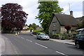
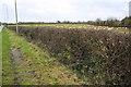
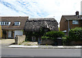
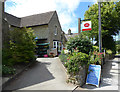
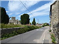
Photos of OX2 9PX


Area Information
OX2 9PX represents a specific residential cluster within Oxford, covering an area of 25.8 hectares. This postcode supports a population of 2,100 people, resulting in a density of 658 people per square kilometre. You are looking at a tightly knit environment where the housing stock is concentrated over a relatively small footprint. Daily life here revolves around the practicalities of this compact scale, meaning neighbours are likely to be within a short walking distance of one another. The area is defined by its residential nature, devoid of the heavy commercial or industrial noise found in larger urban zones. Prospective buyers considering this location should note that it functions as a distinct pocket of Oxford rather than a sprawling suburb. The immediacy of the community is a defining feature, offering a sense of place that larger districts might dilute. If you value a neighbourhood where distances are manageable and the local character is pronounced, OX2 9PX delivers a clear and focused living experience. The area's small size ensures that changes in the local environment are visible to residents quickly. This makes it an area where community decisions and local events have a more immediate impact on daily life compared to widespread municipal districts.
- Area Type
- Postcode
- Area Size
- 25.8 hectares
- Population
- 2100
- Population Density
- 658 people/km²
The property market in OX2 9PX is characterised by a strong preference for ownership, with 82% of homes owned outright or with a mortgage. This statistic drives the nature of the local housing stock, which consists predominantly of houses. You will find very few rental properties or shared living arrangements within this specific cluster of 25.8 hectares. The high level of home ownership suggests that the area attracts buyers who are looking to settle permanently rather than commute through a student accommodation market. When buying a home here, you are entering a market where sellers are often looking to move from their current family-sized dwelling rather than downsizing from a large mansion block. The concentration of houses means buyers can expect typical suburban layouts with gardens and driveway access. This contrasts sharply with the flat markets found in central Oxford or other high-density zones. The 82% ownership rate creates a market where values are steadier and less volatile than in areas dominated by short-term leases. If you are considering purchasing a property in OX2 9PX, you are joining a neighbourhood of owners who have made a long-term commitment to the location.
House Prices in OX2 9PX
Showing 38 properties
| Address | Type | Beds | Baths | Last Sale Price | Last Sale Date | |
|---|---|---|---|---|---|---|
| 1A Chawley Lane, Cumnor, Oxford, OX2 9PX | Maisonette | 2 | 1 | £290,000 | Feb 2025 | |
| The Stables, 59 Chawley Lane, Cumnor, Oxford, OX2 9PX | house | - | - | £530,500 | Feb 2025 | |
| 17 Chawley Lane, Cumnor, Oxford, OX2 9PX | Terraced | 2 | 1 | £265,000 | Nov 2024 | |
| 4A Chawley Lane, Cumnor, Oxford, OX2 9PX | Maisonette | 2 | - | £330,000 | Nov 2022 | |
| 3A Chawley Lane, Cumnor, Oxford, OX2 9PX | Flat | - | - | £265,000 | Feb 2022 | |
| 15 Chawley Lane, Cumnor, Oxford, OX2 9PX | Terraced | 2 | 1 | £365,000 | Mar 2018 | |
| 2 Chawley Lane, Cumnor, Oxford, OX2 9PX | house | 3 | - | £425,000 | Apr 2017 | |
| 2A Chawley Lane, Cumnor, Oxford, OX2 9PX | Terraced | 3 | 1 | £425,000 | Mar 2017 | |
| 33 Chawley Lane, Cumnor, Oxford, OX2 9PX | Detached | 4 | - | £775,000 | Dec 2015 | |
| 6 Chawley Lane, Cumnor, Oxford, OX2 9PX | Bungalow | - | - | £250,000 | Apr 2010 |
Energy Efficiency in OX2 9PX
Residents of OX2 9PX enjoy access to five retail venues and stations within practical reach, ensuring daily errands are convenient. Notable shopping options include Tesco Botley, Iceland Oxford, and Morrisons Daily. These supermarkets provide essential goods and household items without the need to travel long distances. You can find your groceries and household necessities at Tesco Botley or Morrisons Daily, both located nearby. For rail commuters or visitors, Oxford Parkway Railway Station and Radley Railway Station are key transport hubs close to the postcode. The presence of Iceland Oxford adds variety to the local food choices, offering a larger format shopping experience. This blend of supermarkets and stations means you can shop for your weekly meal plan or catch a train for the day with minimal effort. The convenience of these five amenities transforms the area into a functional residential zone where daily life does not require complex planning. Living in OX2 9PX means having your essential services located within an easy commute or short drive.
Amenities
Schools
Families looking for education options near OX2 9PX have one primary choice listed in the immediate vicinity: Cumnor Church of England School (Voluntary Controlled). This establishment holds a Good Ofsted rating, which is a significant indicator of educational quality for parents considering schools in the area. The presence of a voluntary controlled school suggests a community-supported institution, often favoured by families seeking traditional academic or religious values combined with state education. While the data only confirms this one primary school, its Good rating provides a reassuring fact for those evaluating living in OX2 9PX with children. You should note that the data does not list secondary schools, meaning families may need to look further afield for high school placements. The reliance on a single nearby primary school highlights the close-knit nature of the local network. When you visit schools near OX2 9PX, the focus is likely on the performance of Cumnor Church of England School, as no other primary establishments are recorded in the provided information.
| Rank | School | Type | Entry gender | Ages |
|---|
Explore more schools in this area
Go to Schools tabDemographics
The community within OX2 9PX is dominated by adults, with the most common age range falling between 30 and 64 years. The median age across the postcode stands at 47, indicating a mature resident base. Home ownership is the prevailing arrangement for households, with an impressive 82% of properties owner-occupied. This high figure suggests a stable community where long-term residents often remain in the same homes for decades. The accommodation type consists almost entirely of houses, confirming the area's suburban residential character. There are no blocks of flats or shared housing schemes included in the current stock data for this specific cluster. The predominant ethnic group reported is White, reflecting the demographic makeup of the region. This area appeals to families and professionals who have settled into the Oxford region and built roots there. The age profile aligns well with the ownership statistics, showing a population that has likely invested in their local homes. For anyone researching who lives here, the data presents a clear picture of established, middle-aged homeowners living in detached or semi-detached properties rather than young renters or retirees in mobile homes.
Household Size
Accommodation Type
Tenure
Ethnic Group
Religion
Household Composition
Age
Household Deprivation
NS-SEC
Explore more demographic insights in this area
Go to Demographics tabPlanning
Planning Constraints
- Flood RiskPremium
- Ramsar Wetland SitesPremium
- Area of Outstanding Natural BeautyPremium
- Protected Nature ReservePremium
- Protected WoodlandPremium