Area Overview for OX2 9JE
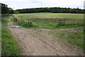
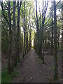
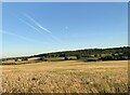
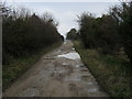
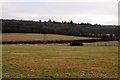
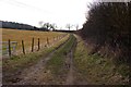
Photos of OX2 9JE


Area Information
Living in OX2 9JE offers a settled residential experience defined by density and established neighbourhood character. This specific postcode cluster covers just 11.0 hectares, containing a population of 1,922 people. The resulting population density stands at 17,492 people per square kilometre, creating an environment where amenities are within easy reach and daily proceedings have a clear rhythm. You will find yourself in a small residential group rather than a sprawling town, which often translates to quieter streets and a focused community vibe. The area functions as a tight-knit housing cluster where most residents know their surroundings intimately. There are no large industrial zones or vast greenspaces within these boundaries, so your daily life centres on the immediate neighbourhood. The scale of 11 hectares ensures that you can traverse the main parts of this cluster quickly on foot or by bike. This compact layout supports a lifestyle where practicality outweighs expansive suburban sprawl. You are buying into a defined slice of Oxfordshire housing rather than a broad district, giving you certainty about exactly where you will be living and the specific character of your immediate environment.
- Area Type
- Postcode
- Area Size
- 11.0 hectares
- Population
- 1922
- Population Density
- 2429 people/km²
The property market in OX2 9JE is dominated by owner-occupiers rather than landlords or investors. With 81% of residents owning their homes, you will encounter a market driven by individuals selling their equity or downsizing rather than families in temporary rentals seeking flexible terms. Houses constitute the primary accommodation type, so expect a range of bungalows, detached homes, and semi-detached properties rather than apartment blocks. This high ownership rate implies that land values and house prices here are heavily influenced by long-term equity growth and local demand from established families. Buyers looking at this small area will find that competition often comes from current owners wishing to release tied-up capital. The nature of the housing stock means there is little rental pressure to disrupt neighbourhood stability. If you are purchasing a home in OX2 9JE, you are joining a community composed mostly of long-term residents. This stability often results in well-maintained properties and a consistent value proposition that does not fluctuate wildly with short-term housing market trends.
House Prices in OX2 9JE
No properties found in this postcode.
Energy Efficiency in OX2 9JE
Residents of OX2 9JE enjoy convenient access to major retail chains and railway stations situated within practical reach. You can shop at Tesco Botley, Iceland Oxford, and Morrisons Daily, providing comprehensive grocery and household needs without a long commute into central Oxford. These five prominent retailers allow you to handle most daily shopping requirements from your doorstep. For rail travel, Oxford Parkway Railway Station and Radley Railway Station are located nearby, offering straightforward connections for those who need to travel. This combination of retail giants and train stations creates a lifestyle where daily errands and occasional trips away are both simple tasks. The area blends the quiet of residential living with the convenience of established commercial hubs. You do not need to venture far to find fresh food or catch a train for an afternoon in the city. This proximity to key amenities ensures that living in OX2 9JE remains practical despite the small size of the immediate postcode cluster.
Amenities
Schools
Families considering OX2 9JE have access to the Matthew Arnold School, which serves as both a primary and academy facility. The school holds a good Ofsted rating, providing assurance of educational standards for younger children. Because this is a single establishment serving both primary needs and academy status, families in this postcode rely heavily on one key institution within the community. The presence of an academy designation suggests the school operates with greater independence from local authority control, often bringing specific pedagogical approaches to its curriculum. While there are no secondary schools listed in the immediate data for this specific cluster, the Matthew Arnold School forms the core educational foundation for the neighbourhood. Schools near OX2 9JE offer a straightforward option without the complexity of multiple academy trusts or foundation schools in the immediate vicinity. Parents will need to plan carefully regarding secondary education, as the listed data points are concentrated at the primary and academy level for this specific location.
| Rank | School | Type | Entry gender | Ages |
|---|
Explore more schools in this area
Go to Schools tabDemographics
The community in OX2 9JE is mature and stable, dominated by middle-aged residents and secure homeownership. The median age across the postcode is 47 years, with the most common age range falling between 30 and 64 years. This demographic skews towards adults and empty nesters rather than young families or students, giving the area a quiet, established feel home ownership reaches an impressive 81%, indicating that the majority of residents purchased their properties long ago. Houses form the predominant accommodation type, meaning you will not find numerous flats or high-rise blocks in this cluster. The ethnic makeup is overwhelmingly White, reflecting the traditional demographics of this particular Oxford suburb. With such a high rate of homeownership, the area feels less transient and more deeply rooted. The concentration of older adult residents suggests a demand for practical housing and convenient local services rather than youth-oriented entertainment. This stable population profile reduces short-term turnover, fostering a sense of continuity for anyone considering this postcode. You are moving into an area where neighbours have likely been there for decades, creating a predictable social environment.
Household Size
Accommodation Type
Tenure
Ethnic Group
Religion
Household Composition
Age
Household Deprivation
NS-SEC
Explore more demographic insights in this area
Go to Demographics tabPlanning
Planning Constraints
- Flood RiskPremium
- Ramsar Wetland SitesPremium
- Area of Outstanding Natural BeautyPremium
- Protected Nature ReservePremium
- Protected WoodlandPremium