Area Overview for OX2 9JA
Photos of OX2 9JA
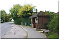
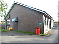


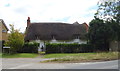
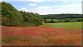
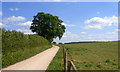
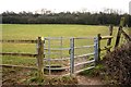
32 photos from this area
Area Information
Key information about the OX2 9JA including its size, population, and administrative classification.
- Area Type
- Postcode
- Area Size
- 4.0 hectares
- Population
- 2100
- Population Density
- 658 people/km²
House Prices in OX2 9JA
28
Properties
£463,329
Average Sold Price
£172,500
Lowest Price
£1,035,000
Highest Price
Showing 28 properties
| Address | Type | Beds | Baths | Last Sale Price | Last Sale Date | |
|---|---|---|---|---|---|---|
| Dormer House, Cumnor Hill, Oxford, OX2 9JA | Detached | 4 | 3 | £1,035,000 | Jun 2022 | |
| 111 Cumnor Hill, Oxford, OX2 9JA | Detached | 4 | 3 | £675,000 | Mar 2014 | |
| 143 Cumnor Hill, Oxford, OX2 9JA | house | 4 | - | £625,000 | Feb 2012 | |
| 137 Cumnor Hill, Oxford, OX2 9JA | Detached | 5 | 4 | £465,000 | Dec 2010 | |
| 141A Cumnor Hill, Oxford, OX2 9JA | house | - | - | £405,000 | Mar 2010 | |
| 133 Cumnor Hill, Oxford, OX2 9JA | Semi-detached | - | - | £550,000 | May 2009 | |
| 139 Cumnor Hill, Oxford, OX2 9JA | Terraced | - | - | £360,000 | Jun 2008 | |
| 113 Cumnor Hill, Oxford, OX2 9JA | house | 5 | - | £910,000 | Aug 2006 | |
| 119 Cumnor Hill, Oxford, OX2 9JA | house | - | - | £485,000 | May 2006 | |
| 135 Cumnor Hill, Oxford, OX2 9JA | Detached | - | - | £370,000 | Oct 2005 |
Page 1 of 3
Energy Efficiency in OX2 9JA
Amenities
Schools
| Rank | School | Type | Entry gender | Ages |
|---|
Explore more schools in this area
Go to Schools tabDemographics
Household Size
Family (3-5 people)
most common
Accommodation Type
Houses
most common
Tenure
82
majority
Ethnic Group
White
most common
Religion
N/A
most common
Household Composition
N/A
most common
Age
47
median
Adults (30-64 years)
most common
Household Deprivation
N/A
with no deprivation
NS-SEC
55
in Lower managerial occupations
Explore more demographic insights in this area
Go to Demographics tabPlanning
Planning Constraints
- Flood RiskPremium
- Ramsar Wetland SitesPremium
- Area of Outstanding Natural BeautyPremium
- Protected Nature ReservePremium
- Protected WoodlandPremium