Area Overview for OX2 9BG
Photos of OX2 9BG


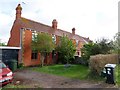

99 photos from this area
Area Information
Key information about the OX2 9BG including its size, population, and administrative classification.
- Area Type
- Postcode
- Area Size
- 7.9 hectares
- Population
- 2018
- Population Density
- 1072 people/km²
House Prices in OX2 9BG
30
Properties
£1,086,630
Average Sold Price
£449,950
Lowest Price
£1,740,000
Highest Price
Showing 30 properties
| Address | Type | Beds | Baths | Last Sale Price | Last Sale Date | |
|---|---|---|---|---|---|---|
| Maple House, Yarnells Hill, Oxford, OX2 9BG | Detached | 6 | 5 | £1,500,000 | Sep 2024 | |
| Wolfson House, Yarnells Hill, Oxford, OX2 9BG | Retail | 5 | 4 | £1,580,000 | Oct 2022 | |
| Yarnells, Yarnells Hill, Oxford, OX2 9BG | Detached | 5 | 5 | £1,740,000 | Jul 2021 | |
| Merton House, Yarnells Hill, Oxford, OX2 9BG | house | - | - | £1,150,000 | Mar 2018 | |
| Willow House, Yarnells Hill, Oxford, OX2 9BG | house | - | - | £1,025,000 | Mar 2016 | |
| Worcester House, Yarnells Hill, Oxford, OX2 9BG | Detached | 5 | - | £1,022,500 | Aug 2015 | |
| Sweetmans Cottage, Yarnells Hill, Oxford, OX2 9BG | house | - | - | £997,000 | Jun 2013 | |
| South Hayes, Yarnells Hill, Oxford, OX2 9BG | house | 5 | - | £1,350,000 | Nov 2012 | |
| Harcourt Dene, Yarnells Hill, Oxford, OX2 9BG | Detached | - | - | £1,020,000 | Dec 2009 | |
| Foxcombe Dene, Yarnells Hill, Oxford, OX2 9BG | Detached | - | - | £1,160,000 | Jan 2008 |
Page 1 of 3
Energy Efficiency in OX2 9BG
Amenities
Schools
| Rank | School | Type | Entry gender | Ages |
|---|
Explore more schools in this area
Go to Schools tabDemographics
Household Size
Family (3-5 people)
most common
Accommodation Type
Houses
most common
Tenure
74
majority
Ethnic Group
White
most common
Religion
N/A
most common
Household Composition
N/A
most common
Age
47
median
Adults (30-64 years)
most common
Household Deprivation
N/A
with no deprivation
NS-SEC
45
in Lower managerial occupations
Explore more demographic insights in this area
Go to Demographics tabPlanning
Planning Constraints
- Flood RiskPremium
- Ramsar Wetland SitesPremium
- Area of Outstanding Natural BeautyPremium
- Protected Nature ReservePremium
- Protected WoodlandPremium