Area Overview for OX2 8PE
Photos of OX2 8PE

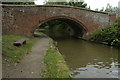
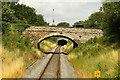
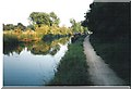
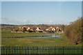
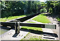
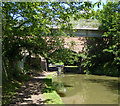
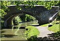
99 photos from this area
Area Information
Key information about the OX2 8PE including its size, population, and administrative classification.
- Area Type
- Postcode
- Area Size
- 11.2 hectares
- Population
- 1619
- Population Density
- 1017 people/km²
House Prices in OX2 8PE
29
Properties
£353,903
Average Sold Price
£124,000
Lowest Price
£806,100
Highest Price
Showing 29 properties
| Address | Type | Beds | Baths | Last Sale Price | Last Sale Date | |
|---|---|---|---|---|---|---|
| 83 Godstow Road, Oxford, OX2 8PE | Cottage | 2 | 1 | £380,083 | Nov 2025 | |
| 77 Godstow Road, Oxford, OX2 8PE | house | 1 | - | £495,000 | Dec 2020 | |
| 61 Godstow Road, Oxford, OX2 8PE | Terraced | 3 | 1 | £495,000 | Jul 2020 | |
| 51 Godstow Road, Oxford, OX2 8PE | Cottage | 1 | - | £250,000 | Apr 2012 | |
| 43 Godstow Road, Oxford, OX2 8PE | house | 4 | - | £806,100 | Nov 2011 | |
| 81 Godstow Road, Oxford, OX2 8PE | house | - | - | £265,000 | Jan 2009 | |
| 63 Godstow Road, Oxford, OX2 8PE | Terraced | - | - | £124,000 | Jan 2009 | |
| 79 Godstow Road, Oxford, OX2 8PE | house | 3 | - | £244,500 | May 2008 | |
| 55 Godstow Road, Oxford, OX2 8PE | Cottage | 1 | 1 | £145,000 | Feb 2006 | |
| 65 Godstow Road, Oxford, OX2 8PE | Semi-detached | 3 | 2 | £278,250 | Feb 2004 |
Page 1 of 3
Energy Efficiency in OX2 8PE
Amenities
Schools
| Rank | School | Type | Entry gender | Ages |
|---|
Explore more schools in this area
Go to Schools tabDemographics
Household Size
Family (3-5 people)
most common
Accommodation Type
Houses
most common
Tenure
69
majority
Ethnic Group
White
most common
Religion
N/A
most common
Household Composition
N/A
most common
Age
47
median
Adults (30-64 years)
most common
Household Deprivation
N/A
with no deprivation
NS-SEC
48
in Lower managerial occupations
Explore more demographic insights in this area
Go to Demographics tabPlanning
Planning Constraints
- Flood RiskPremium
- Ramsar Wetland SitesPremium
- Area of Outstanding Natural BeautyPremium
- Protected Nature ReservePremium
- Protected WoodlandPremium