Area Overview for OX2 8DB
Photos of OX2 8DB

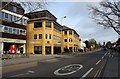
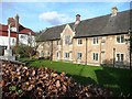
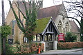
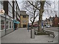
100 photos from this area
Area Information
Key information about the OX2 8DB including its size, population, and administrative classification.
- Area Type
- Postcode
- Area Size
- 5484 m²
- Population
- 1447
- Population Density
- 2289 people/km²
House Prices in OX2 8DB
45
Properties
£302,809
Average Sold Price
£69,000
Lowest Price
£695,000
Highest Price
Showing 45 properties
| Address | Type | Beds | Baths | Last Sale Price | Last Sale Date | |
|---|---|---|---|---|---|---|
| 22 Woodstock Close, Oxford, OX2 8DB | Flat | 2 | 1 | £498,927 | Sep 2025 | |
| 17 Woodstock Close, Oxford, OX2 8DB | Flat | 1 | - | £260,000 | Nov 2024 | |
| 39 Woodstock Close, Oxford, OX2 8DB | Flat | 2 | 1 | £340,000 | Jun 2021 | |
| 20 Woodstock Close, Oxford, OX2 8DB | Flat | - | - | £340,000 | Jun 2021 | |
| 10 Woodstock Close, Oxford, OX2 8DB | Flat | - | - | £335,000 | May 2021 | |
| 24 Woodstock Close, Oxford, OX2 8DB | Flat | - | - | £550,000 | Feb 2021 | |
| 3 Woodstock Close, Oxford, OX2 8DB | Flat | - | - | £695,000 | Nov 2020 | |
| 21 Woodstock Close, Oxford, OX2 8DB | Flat | - | - | £457,500 | Jun 2019 | |
| 33 Woodstock Close, Oxford, OX2 8DB | Flat | 3 | 1 | £540,000 | Dec 2018 | |
| 15 Woodstock Close, Oxford, OX2 8DB | Flat | - | - | £537,500 | Jan 2017 |
Page 1 of 5
Energy Efficiency in OX2 8DB
Amenities
Schools
| Rank | School | Type | Entry gender | Ages |
|---|
Explore more schools in this area
Go to Schools tabDemographics
Household Size
One person
most common
Accommodation Type
Houses
most common
Tenure
67
majority
Ethnic Group
White
most common
Religion
N/A
most common
Household Composition
N/A
most common
Age
47
median
Adults (30-64 years)
most common
Household Deprivation
N/A
with no deprivation
NS-SEC
62
in Lower managerial occupations
Explore more demographic insights in this area
Go to Demographics tabPlanning
Planning Constraints
- Flood RiskPremium
- Ramsar Wetland SitesPremium
- Area of Outstanding Natural BeautyPremium
- Protected Nature ReservePremium
- Protected WoodlandPremium