Area Overview for OX2 8BY
Photos of OX2 8BY

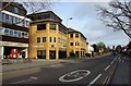
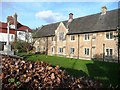
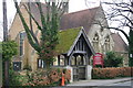
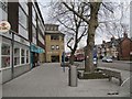
100 photos from this area
Area Information
Key information about the OX2 8BY including its size, population, and administrative classification.
- Area Type
- Postcode
- Area Size
- 1.5 hectares
- Population
- 1447
- Population Density
- 2289 people/km²
House Prices in OX2 8BY
23
Properties
£1,323,935
Average Sold Price
£155,000
Lowest Price
£1,992,000
Highest Price
Showing 23 properties
| Address | Type | Beds | Baths | Last Sale Price | Last Sale Date | |
|---|---|---|---|---|---|---|
| 36 Davenant Road, Oxford, OX2 8BY | Detached | 5 | 3 | £1,800,000 | Aug 2024 | |
| Site Of Former 30, Davenant Road, Oxford, OX2 8BY | Detached | 5 | 1 | £1,386,000 | May 2023 | |
| 34 Davenant Road, Oxford, OX2 8BY | Semi-detached | 5 | 4 | £1,340,000 | Nov 2021 | |
| 38 Davenant Road, Oxford, OX2 8BY | house | - | - | £1,950,000 | Aug 2017 | |
| 44 Davenant Road, Oxford, OX2 8BY | house | - | - | £1,330,000 | Nov 2016 | |
| 48A Davenant Road, Oxford, OX2 8BY | Semi-detached | 5 | 4 | £1,992,000 | Jul 2016 | |
| 40 Davenant Road, Oxford, OX2 8BY | house | 4 | - | £1,721,350 | Mar 2016 | |
| 46 Davenant Road, Oxford, OX2 8BY | house | - | - | £615,000 | Dec 2009 | |
| 28 Davenant Road, Oxford, OX2 8BY | Detached | - | - | £950,000 | Jan 2008 | |
| 42 Davenant Road, Oxford, OX2 8BY | Semi-detached | 4 | 2 | £155,000 | Apr 1996 |
Page 1 of 3
Energy Efficiency in OX2 8BY
Amenities
Schools
| Rank | School | Type | Entry gender | Ages |
|---|
Explore more schools in this area
Go to Schools tabDemographics
Household Size
One person
most common
Accommodation Type
Houses
most common
Tenure
67
majority
Ethnic Group
White
most common
Religion
N/A
most common
Household Composition
N/A
most common
Age
47
median
Adults (30-64 years)
most common
Household Deprivation
N/A
with no deprivation
NS-SEC
62
in Lower managerial occupations
Explore more demographic insights in this area
Go to Demographics tabPlanning
Planning Constraints
- Flood RiskPremium
- Ramsar Wetland SitesPremium
- Area of Outstanding Natural BeautyPremium
- Protected Nature ReservePremium
- Protected WoodlandPremium