Area Overview for OX2 7EP
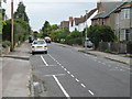
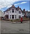
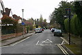
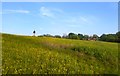
Photos of OX2 7EP


Area Information
OX2 7EP represents a compact residential cluster covering just one hectare in Oxford, England. This small postcode serves 1,270 residents within a highly concentrated footprint, resulting in a population density of 124,463 people per square kilometre. The area functions as a defined residential zone rather than a sprawling neighbourhood, offering a close-knit living environment where proximity to neighbours is high. Daily life here is characterised by the density of human habitation within a very limited geographical space. Residents navigate a setting where household numbers are packed into a footprint comparable to large public parks in other cities. Living in OX2 7EP means accepting a high-density environment typical of specific Oxford postcodes. The area does not stretch far, which simplifies local exploration but concentrates activity into a small radius. This postcode type caters to those who value immediate access to surrounding amenities without travelling far. The sheer concentration of homes defines the character of the location, creating an urban feel despite being within Oxfordshire. Prospective buyers should understand that this specific address sits within a tightly packed residential network.
- Area Type
- Postcode
- Area Size
- 1.0 hectares
- Population
- 1270
- Population Density
- 3112 people/km²
The property market in OX2 7EP is firmly rooted in private ownership, with 60% of households owning their homes outright or with a mortgage. The remaining 40% of the market consists of renters, though specific rental yield data is not available for this small cluster. High home ownership levels typically indicate a stable neighbourhood where families have invested in their properties over time. This dynamic often supports stronger local schools and maintained public spaces, as owners have a direct stake in preserving the area's value. Properties in this postcode are primarily houses, distinguishing them from the student-led rental markets found in older city centres. The dominance of houses suggests a market focused on residential comfort and space rather than studio living or shared flats. For buyers considering homes in OX2 7EP, the high ownership rate implies that sale_prices move with the broader housing market trends rather than volatile rental fluctuations. The small size of the area, at just one hectare, means that inventory is likely limited. Purchasing here requires looking at existing stock within the restricted boundaries of OX2 7EP or immediately surrounding postcodes.
House Prices in OX2 7EP
Showing 13 properties
| Address | Type | Beds | Baths | Last Sale Price | Last Sale Date | |
|---|---|---|---|---|---|---|
| 68 Lonsdale Road, Oxford, OX2 7EP | house | - | - | £1,635,000 | Jan 2021 | |
| 56 Lonsdale Road, Oxford, OX2 7EP | house | - | - | £1,150,000 | Aug 2016 | |
| 52 Lonsdale Road, Oxford, OX2 7EP | Semi-detached | 5 | 1 | £1,220,000 | Aug 2013 | |
| 58 Lonsdale Road, Oxford, OX2 7EP | house | 5 | - | £1,145,500 | Feb 2012 | |
| 62 Lonsdale Road, Oxford, OX2 7EP | Semi-detached | 4 | 2 | £925,000 | Sep 2010 | |
| 50 Lonsdale Road, Oxford, OX2 7EP | house | - | - | £537,250 | Aug 2002 | |
| 60 Lonsdale Road, Oxford, OX2 7EP | house | - | - | £525,000 | Nov 2001 | |
| 70 Lonsdale Road, Oxford, OX2 7EP | Semi-detached | - | - | £370,000 | Aug 1998 | |
| 46 Lonsdale Road, Oxford, OX2 7EP | Semi-detached | 4 | - | - | - | |
| 54 Lonsdale Road, Oxford, OX2 7EP | Semi-detached | - | - | - | - |
Energy Efficiency in OX2 7EP
Residents of OX2 7EP enjoy immediate access to several retail and transport hubs within practical reach. Local shopping is handled by five key retailers, including Sainsburys Oxford, Tesco Oxford, and M&S Summertown SF. These venues provide daily necessities, allowing residents to shop for groceries and household items without travelling far out of the area. The concentration of these major chains ensures that convenience is a high priority for local life. Transport links are extensive, with three railway stations nearby: Oxford Parkway, Islip, and Hanborough. Oxford Parkway offers the fastest route to London, while Islip and Hanborough provide local interchange options. For air travel, two airports lie within reach: London Oxford Airport and Oxford (Kidlington) Airport. This combination of rail and air access means commuting to London or regional business trips is straightforward. Lifestyle in OX2 7EP balances suburban convenience with major transport arteries, giving residents agility in how they travel.
Amenities
Schools
Families looking for education options near OX2 7EP have access to Summer Fields School. This independent school is situated in close proximity to the postcode, offering an alternative to the state sector. Independent schools often provide a curriculum and environment tailored to specific educational philosophies, distinct from the comprehensive model of state schools. While Summer Fields School serves as the primary nearby institution listed for this area, it does not offer a state-run alternative in the immediate vicinity. The presence of an independent school suggests that residents may prioritise private education for their children or utilise these facilities for comprehensive care. There are no state primary or secondary schools listed in the data for OX2 7EP, meaning all families must choose between this independent option or transport arrangements to further-flung schools. For those considering living in OX2 7EP, the school choice is a specific one: enrolment at Summer Fields School or travel to other districts. The distinct character of an independent institution shapes the local educational landscape, catering to a demographic that values private schooling structures.
| Rank | School | Type | Entry gender | Ages |
|---|
Explore more schools in this area
Go to Schools tabDemographics
The community in OX2 7EP reflects a mature demographic profile with a median age of 47 years. The most common age group consists of adults between 30 and 64 years old, indicating that the area primarily houses working professionals and established families. House ownership stands at a solid 60%, suggesting that a significant portion of residents have bought into the local market rather than renting. This level of ownership often correlates with greater stability within the community and a settled residential atmosphere. Accommodation in OX2 7EP consists exclusively of houses, with no apartments or flats recorded in the visible data for this specific cluster. This housing type aligns directly with the older demographic and the preference for detached or semi-detached living found in the 30-64 age range. The predominant ethnic group is White, which forms the majority of the population according to current records. These figures paint a picture of a traditional, stable English suburb where long-term residents have established deep roots. The lack of younger families or学生宿舍 suggests the area may appeal more to those seeking a quiet, established home environment rather than a young professional hub with high turnover.
Household Size
Accommodation Type
Tenure
Ethnic Group
Religion
Household Composition
Age
Household Deprivation
NS-SEC
Explore more demographic insights in this area
Go to Demographics tabPlanning
Planning Constraints
- Flood RiskPremium
- Ramsar Wetland SitesPremium
- Area of Outstanding Natural BeautyPremium
- Protected Nature ReservePremium
- Protected WoodlandPremium