Area Overview for OX2 6UY
Photos of OX2 6UY

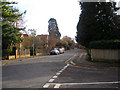
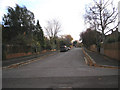


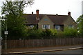
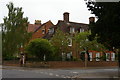
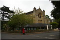
60 photos from this area
Area Information
Key information about the OX2 6UY including its size, population, and administrative classification.
- Area Type
- Postcode
- Area Size
- 1.6 hectares
- Population
- 2521
- Population Density
- 2087 people/km²
House Prices in OX2 6UY
15
Properties
£1,285,833
Average Sold Price
£310,000
Lowest Price
£3,000,000
Highest Price
Showing 15 properties
| Address | Type | Beds | Baths | Last Sale Price | Last Sale Date | |
|---|---|---|---|---|---|---|
| 5 Garford Road, Oxford, OX2 6UY | house | - | - | £3,000,000 | Oct 2024 | |
| 3 Garford Road, Oxford, OX2 6UY | house | - | - | £1,700,000 | Nov 2011 | |
| Garford House, Garford Road, Oxford, OX2 6UY | house | - | - | £1,850,000 | Jul 2007 | |
| 4 Garford Road, Oxford, OX2 6UY | Detached | 6 | 3 | £310,000 | Nov 2003 | |
| 2 Garford Road, Oxford, OX2 6UY | house | - | - | £410,000 | Sep 1997 | |
| 1 Garford Road, Oxford, OX2 6UY | Terraced | 6 | - | £445,000 | May 1997 | |
| Loft Flat, 4 Garford Road, Oxford, OX2 6UY | Flat | - | - | - | - | |
| 15 Garford Road, Oxford, OX2 6UY | house | - | - | - | - | |
| 17 Garford Road, Oxford, OX2 6UY | house | - | - | - | - | |
| 19 Garford Road, Oxford, OX2 6UY | house | - | - | - | - |
Page 1 of 2
Energy Efficiency in OX2 6UY
Amenities
Schools
| Rank | School | Type | Entry gender | Ages |
|---|
Explore more schools in this area
Go to Schools tabDemographics
Household Size
One person
most common
Accommodation Type
Flats
most common
Tenure
53
majority
Ethnic Group
White
most common
Religion
N/A
most common
Household Composition
N/A
most common
Age
22
median
Young Adults (15-29 years)
most common
Household Deprivation
N/A
with no deprivation
NS-SEC
39
in Lower managerial occupations
Explore more demographic insights in this area
Go to Demographics tabPlanning
Planning Constraints
- Flood RiskPremium
- Ramsar Wetland SitesPremium
- Area of Outstanding Natural BeautyPremium
- Protected Nature ReservePremium
- Protected WoodlandPremium