Area Overview for OX2 6UR
Photos of OX2 6UR
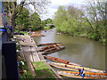
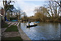

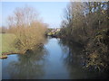
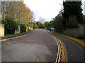
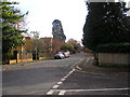
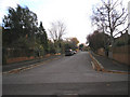


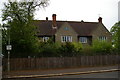
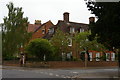

60 photos from this area
Area Information
Key information about the OX2 6UR including its size, population, and administrative classification.
- Area Type
- Postcode
- Area Size
- 2.0 hectares
- Population
- 2521
- Population Density
- 2087 people/km²
House Prices in OX2 6UR
13
Properties
£2,592,024
Average Sold Price
£563,214
Lowest Price
£4,850,000
Highest Price
Showing 13 properties
| Address | Type | Beds | Baths | Last Sale Price | Last Sale Date | |
|---|---|---|---|---|---|---|
| 20 Northmoor Road, Oxford, OX2 6UR | Detached | - | - | £3,650,000 | Aug 2021 | |
| 23 Northmoor Road, Oxford, OX2 6UR | Detached | 4 | 5 | £4,850,000 | Aug 2018 | |
| 25 Northmoor Road, Oxford, OX2 6UR | Detached | 6 | 3 | £2,950,000 | Jul 2017 | |
| 18 Northmoor Road, Oxford, OX2 6UR | house | - | - | £3,500,000 | Mar 2016 | |
| 24 Northmoor Road, Oxford, OX2 6UR | Detached | - | - | £563,214 | Jan 2013 | |
| 33 Northmoor Road, Oxford, OX2 6UR | Semi-detached | 5 | - | £3,300,000 | Nov 2011 | |
| 28 Northmoor Road, Oxford, OX2 6UR | house | 4 | - | £1,365,000 | Mar 2010 | |
| 31 Northmoor Road, Oxford, OX2 6UR | Detached | - | - | £1,380,000 | Sep 2005 | |
| 27 Northmoor Road, Oxford, OX2 6UR | house | - | - | £1,770,000 | Jan 2004 | |
| 27A Northmoor Road, Oxford, OX2 6UR | Semi-detached | - | - | - | - |
Page 1 of 2
Energy Efficiency in OX2 6UR
Amenities
Schools
| Rank | School | Type | Entry gender | Ages |
|---|
Explore more schools in this area
Go to Schools tabDemographics
Household Size
One person
most common
Accommodation Type
Flats
most common
Tenure
53
majority
Ethnic Group
White
most common
Religion
N/A
most common
Household Composition
N/A
most common
Age
22
median
Young Adults (15-29 years)
most common
Household Deprivation
N/A
with no deprivation
NS-SEC
39
in Lower managerial occupations
Explore more demographic insights in this area
Go to Demographics tabPlanning
Planning Constraints
- Flood RiskPremium
- Ramsar Wetland SitesPremium
- Area of Outstanding Natural BeautyPremium
- Protected Nature ReservePremium
- Protected WoodlandPremium