Area Overview for OX2 6TT
Photos of OX2 6TT
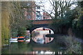
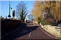
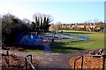
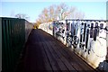
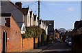
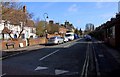
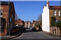
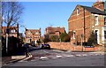
100 photos from this area
Area Information
Key information about the OX2 6TT including its size, population, and administrative classification.
- Area Type
- Postcode
- Area Size
- 6080 m²
- Population
- 2444
- Population Density
- 3614 people/km²
House Prices in OX2 6TT
22
Properties
£684,500
Average Sold Price
£349,000
Lowest Price
£940,000
Highest Price
Showing 22 properties
| Address | Type | Beds | Baths | Last Sale Price | Last Sale Date | |
|---|---|---|---|---|---|---|
| 14 Hayfield Road, Oxford, OX2 6TT | Terraced | 2 | 1 | £760,000 | Jul 2025 | |
| 10 Hayfield Road, Oxford, OX2 6TT | Terraced | 3 | 1 | £640,000 | Jul 2025 | |
| 22 Hayfield Road, Oxford, OX2 6TT | Terraced | 3 | 2 | £940,000 | May 2025 | |
| 26 Hayfield Road, Oxford, OX2 6TT | Terraced | 3 | 1 | £875,000 | Apr 2022 | |
| 30 Hayfield Road, Oxford, OX2 6TT | house | - | - | £827,500 | Sep 2021 | |
| 34 Hayfield Road, Oxford, OX2 6TT | Terraced | 2 | 1 | £805,000 | Apr 2021 | |
| 8 Hayfield Road, Oxford, OX2 6TT | Semi-detached | 2 | 1 | £837,500 | Aug 2017 | |
| 24 Hayfield Road, Oxford, OX2 6TT | house | - | - | £780,000 | Mar 2016 | |
| 32 Hayfield Road, Oxford, OX2 6TT | house | 3 | - | £475,000 | Jul 2011 | |
| 16 Hayfield Road, Oxford, OX2 6TT | Terraced | 2 | 1 | £495,000 | Jan 2011 |
Page 1 of 3
Energy Efficiency in OX2 6TT
Amenities
Schools
| Rank | School | Type | Entry gender | Ages |
|---|
Explore more schools in this area
Go to Schools tabDemographics
Household Size
Two person
most common
Accommodation Type
Houses
most common
Tenure
61
majority
Ethnic Group
White
most common
Religion
N/A
most common
Household Composition
N/A
most common
Age
47
median
Adults (30-64 years)
most common
Household Deprivation
N/A
with no deprivation
NS-SEC
64
in Lower managerial occupations
Explore more demographic insights in this area
Go to Demographics tabPlanning
Planning Constraints
- Flood RiskPremium
- Ramsar Wetland SitesPremium
- Area of Outstanding Natural BeautyPremium
- Protected Nature ReservePremium
- Protected WoodlandPremium