Area Overview for OX2 6SF
Photos of OX2 6SF
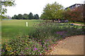


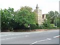
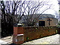
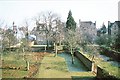

100 photos from this area
Area Information
Key information about the OX2 6SF including its size, population, and administrative classification.
- Area Type
- Postcode
- Area Size
- 9387 m²
- Population
- 2245
- Population Density
- 3076 people/km²
House Prices in OX2 6SF
24
Properties
£2,700,455
Average Sold Price
£1,530,000
Lowest Price
£3,850,000
Highest Price
Showing 24 properties
| Address | Type | Beds | Baths | Last Sale Price | Last Sale Date | |
|---|---|---|---|---|---|---|
| 17 Norham Road, Oxford, OX2 6SF | Semi-detached | 6 | - | £3,000,000 | Nov 2023 | |
| Cherwell College Trinity Hall, 21 Norham Road, Oxford, OX2 6SF | Semi-detached | 6 | 4 | £3,850,000 | Dec 2022 | |
| 20 Norham Road, Oxford, OX2 6SF | Semi-detached | 5 | 2 | £2,625,000 | Jun 2021 | |
| 23 Norham Road, Oxford, OX2 6SF | house | - | - | £2,650,000 | Oct 2020 | |
| 22 Norham Road, Oxford, OX2 6SF | house | 6 | - | £2,860,000 | Nov 2019 | |
| 16 Norham Road, Oxford, OX2 6SF | house | 6 | - | £2,800,000 | Nov 2019 | |
| 13 Norham Road, Oxford, OX2 6SF | Detached | 6 | 4 | £3,450,000 | Dec 2016 | |
| 25 Norham Road, Oxford, OX2 6SF | Semi-detached | 5 | 3 | £2,200,000 | Aug 2013 | |
| 18 Norham Road, Oxford, OX2 6SF | Detached | 5 | 4 | £3,150,000 | Aug 2011 | |
| 24 Norham Road, Oxford, OX2 6SF | Terraced | - | - | £1,590,000 | Feb 2009 |
Page 1 of 3
Energy Efficiency in OX2 6SF
Amenities
Schools
| Rank | School | Type | Entry gender | Ages |
|---|
Explore more schools in this area
Go to Schools tabDemographics
Household Size
One person
most common
Accommodation Type
Houses
most common
Tenure
51
majority
Ethnic Group
White
most common
Religion
N/A
most common
Household Composition
N/A
most common
Age
22
median
Young Adults (15-29 years)
most common
Household Deprivation
N/A
with no deprivation
NS-SEC
37
in Lower managerial occupations
Explore more demographic insights in this area
Go to Demographics tabPlanning
Planning Constraints
- Flood RiskPremium
- Ramsar Wetland SitesPremium
- Area of Outstanding Natural BeautyPremium
- Protected Nature ReservePremium
- Protected WoodlandPremium