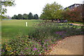
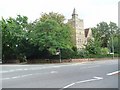
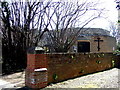
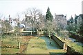
Area Overview for OX2 6LH
Photos of OX2 6LH


Area Information
OX2 6LH represents a specific residential cluster within Oxfordshire, covering a compact area of 376 m². This postcode serves 2,245 residents, creating a tightly knit neighbourhood where every street network impacts daily routine. Living in OX2 6LH means residing in a location defined by its proximity to key Oxfordshire hubs rather than sprawling suburbs. You will find a population density that shapes a distinct community rhythm, blending the convenience of being near major transport links with a contained living environment. The area functions as a practical base for those working in or near Oxford, benefiting from immediate access to essential services without the congestion of the city centre itself. Homes in OX2 6LH cater primarily to a young demographic, reflecting a shift towards modern urban lifestyles. Your daily life involves easy reach to rail stations and shops, supporting a routine grounded in efficiency. The neighbourhood avoids the grandeur of grand estates in favour of functional, accessible housing. Residents here navigate a landscape where the distance between home and work or school remains short. This postcode offers a grounded existence, allowing you to settle into a community where the balance between isolation and connectivity is carefully managed.
- Area Type
- Postcode
- Area Size
- 376 m²
- Population
- 2245
- Population Density
- 3076 people/km²
The property market in OX2 6LH is characterised by a specific housing stock composition and ownership behaviour. Houses dominate the accommodationType landscape, distinguishing this cluster from urban apartment-heavy zones. With 51% home ownership, the area presents a balanced opportunity for both first-time buyers and those looking to consolidate equity. You will find fewer landlords than in investment hotspots, suggesting a community where residents stay longer in one property. This stability is evident in the housing tenure rates, which favour long-term commitments over transient renting. Buyers seeking homes in OX2 6LH should anticipate properties built for families or individuals prioritising space over density. The limited total area of 376 m² means price per square metre may be favourable compared to larger districts, though the total number of available homes remains low. Supply constraints in such a small postcode often drive competition among those wishing to purchase a house in this location. Previous transactions likely reflect a mix of private sales and some local authority involvement. The market here does not cater to luxury importers but rather to those seeking functional living spaces. Your purchasing power will go further if you target houses that match the prevailing architectural norms of the cluster.
House Prices in OX2 6LH
Showing 1 properties
| Address | Type | Beds | Baths | Last Sale Price | Last Sale Date | |
|---|---|---|---|---|---|---|
| Centre For Criminological Research, 12 Bevington Road, Oxford, OX2 6LH | commercial | - | - | - | - |
Energy Efficiency in OX2 6LH
Living in OX2 6LH offers immediate access to a defined set of retail and transport amenities. Retail options include Sainsburys Oxford, Co-op Walton, and Co-op Little, all within practical reach for essential shopping trips. You will find three railway stations pulsing with activity nearby: Oxford Parkway Railway Station, Islip Railway Station, and Radley Railway Station. These stations provide rapid links to London and other major cities, bypassing the need for long drives. Two airports serve the region directly: London Oxford Airport and Oxford (Kidlington) Airport. Business travellers and private flyers benefit from this proximity to aviation hubs. Your daily errands involve navigating a network of five main retail points rather than scattered independent shops. This concentration of amenities ensures that groceries and daily goods are always accessible without traffic delays. The presence of both major supermarkets and local co-ops diversifies your shopping choices. Commuters can switch between rail and road transport with minimal effort given the three stations available. This infrastructure supports a lifestyle where time spent commuting remains low. You can manage work, school runs, and leisure pursuits without leaving the broader Oxfordshire network.
Amenities
Schools
Families considering schools near OX2 6LH have one primary independent option immediately nearby. Dragon School operates as an independent institution within practical commuting distance. This single entry in the nearby Schools list highlights a reliance on selective or fee-paying options rather than comprehensive state education directly in the immediate cluster. Because OX2 6LH contains no primary or secondary state schools listed, residents must look beyond the boundaries of this specific postcode for mainstream education. The presence of Dragon School suggests a significant route for high-achieving students or families with the means for private education. You will find few local state schools if you strictly limit your search to the immediate vicinage of this postcode. Parents may need to commute to Oxford proper for 키워드 schools like Reepham CE Primary School or St Edward's School, which lie outside the 376 m² footprint of this area. The mix of school types available nearby is narrow, focusing on independent provision. If you require a comprehensive state school for your child, your search radius must expand considerably beyond OX2 6LH. This constraint defines the educational landscape for those choosing to live in this specific residential cluster.
| Rank | School | Type | Entry gender | Ages |
|---|
Explore more schools in this area
Go to Schools tabDemographics
The community in OX2 6LH is defined by a young median age of 22 years. MostCommonAgeRange data confirms that Young Adults between 15 and 29 years dominate the population profile. This demographic skew suggests a neighbourhood increasingly suited to students, young couples, or professionals rather than retired residents. Home ownership stands at 51%, indicating a balanced market between rented accommodation and private property buyers. You will encounter a mix of leaseholders and freeholders, which influences the stability of the local tenant pool. The predominantEthnicGroup is White, reflecting the broader historical patterns of Oxfordshire settlement while maintaining diversity. Houses form the primary accommodationType, meaning you will rarely find converted flats or modern purpose-built apartment blocks in this specific cluster. This focus on detached or semi-detached properties contrasts with the high-rises found closer to Oxford city centre. Deprivation levels remain moderate, ensuring quality of life is not significantly hampered by economic struggles. The population density reaches 5965145 people/km², a figure that highlights the concentrated nature of this specific postcode format. Living here means interacting with a cohort largely in their formative twenties, creating a dynamic social atmosphere where peer groups influence local culture.
Household Size
Accommodation Type
Tenure
Ethnic Group
Religion
Household Composition
Age
Household Deprivation
NS-SEC
Explore more demographic insights in this area
Go to Demographics tabPlanning
Planning Constraints
- Flood RiskPremium
- Ramsar Wetland SitesPremium
- Area of Outstanding Natural BeautyPremium
- Protected Nature ReservePremium
- Protected WoodlandPremium